On Sept. 8-11 we were at the Wates-Gibson hut in the Tonquin Valley. A large snowfall from Sept. 6th made Edith Cavell look like full on winter and many other peaks in the area received some new snow. The hike in was quite muddy with all the rain at lower elevations and seemed slow to dry on the hike out after a sunny weekend. Many new wooden bridges on the trail were a welcome sight although Parks could do a lot more to build catwalks over the numerous boggy sections that stay wet all season. This was the topic of discussion for many hut users on our visit as well as entries in the hut log.
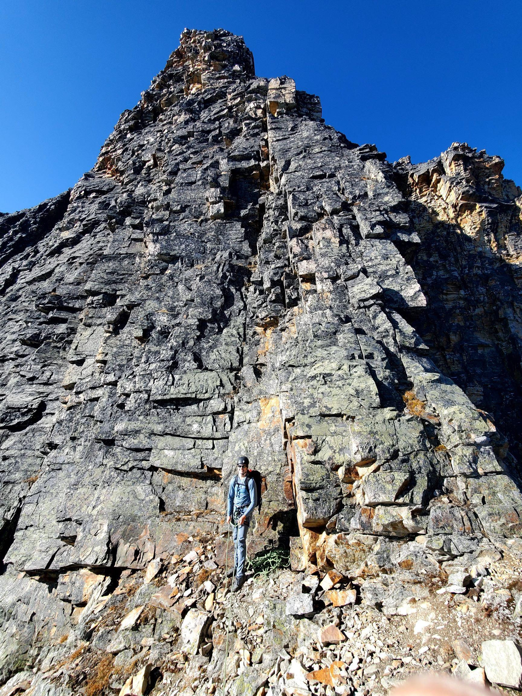
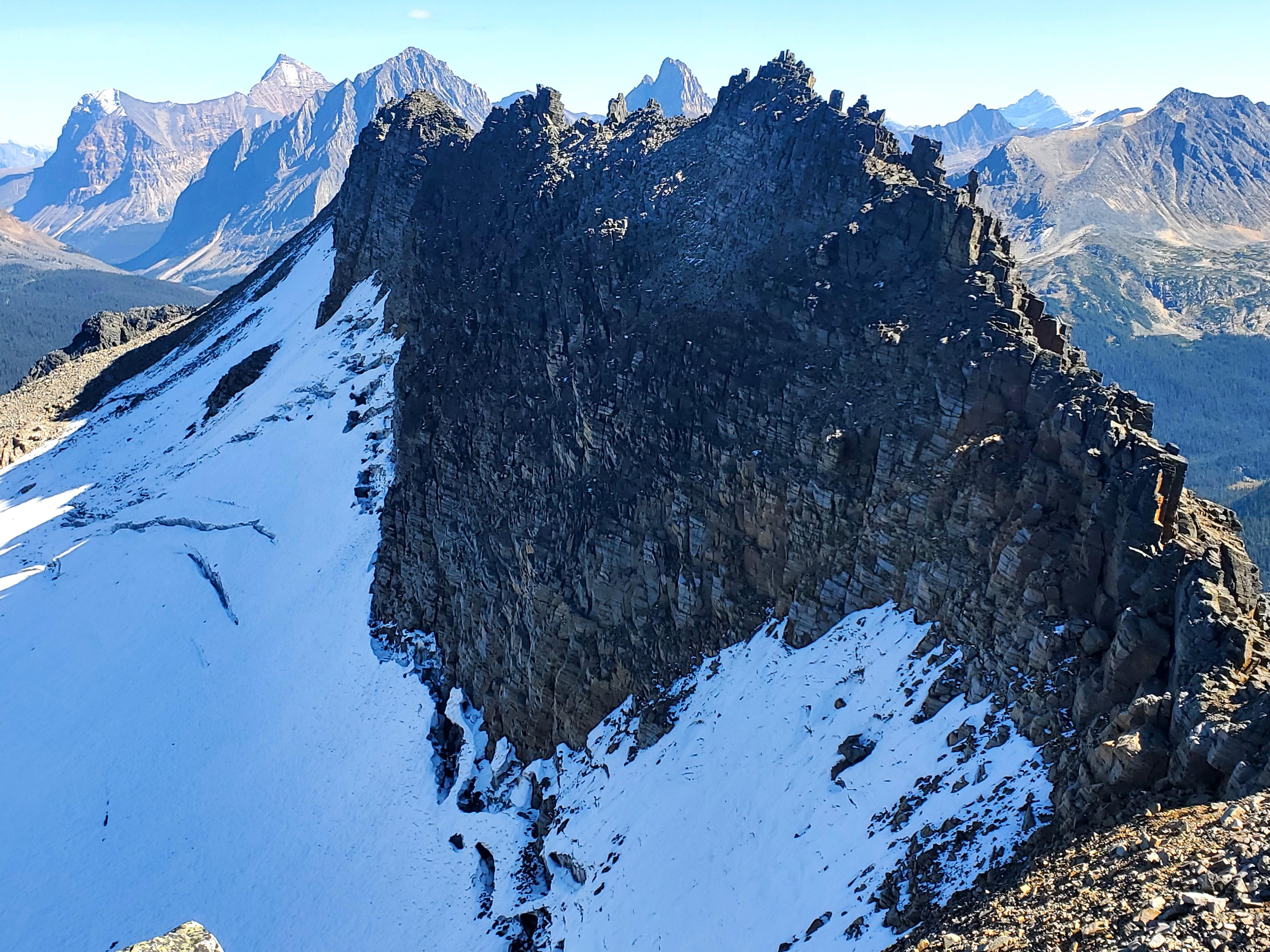
We climbed the N. Buttress of Outpost peak on Saturday which has some good climbing, but we pulled off many loose blocks and would encourage others to do the same as this route doesn’t seem to get much traffic. There is a fair bit of black lichen which was a tad moist for our ascent, but the quartzite holds are quite positive. We descended the SW Ridge which was terrible and tedious with square blocks that slid past each other. We opted for the descender’s right option in hopes of some scree skiing but found only loose rocks over steep, hard ground near the moraines. Staying left seemed more solid, but steeper downclimbing with larger blocks that would be bad if they shifted and squished you.
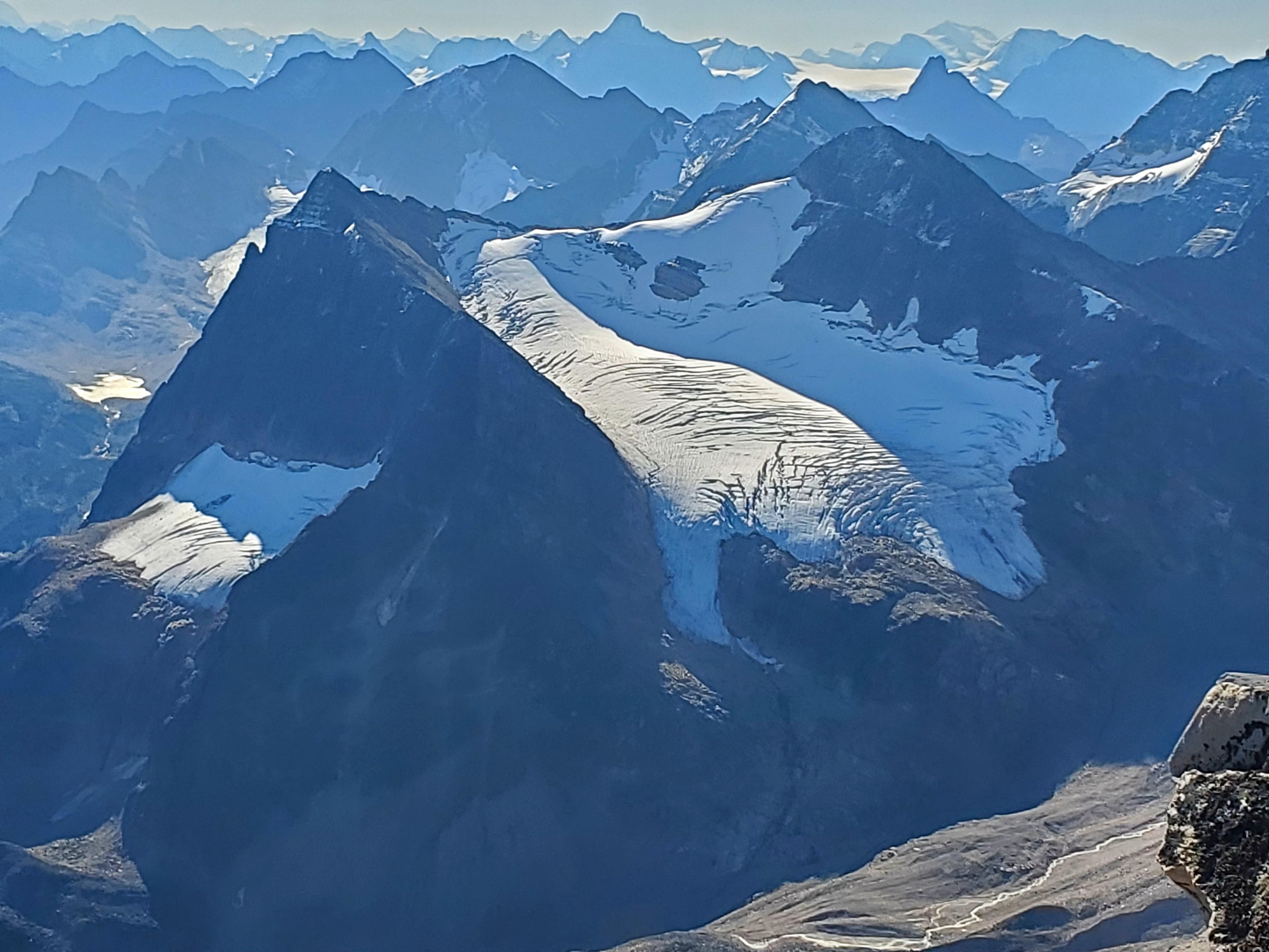
The wonderful Moab-like rock slabs near the glacier were inspiring though and the steep glacier toe is impressive. A key boulder hop at the toe allowed an easy crossing of the raging river and we descended to Arrowhead Lake and easily crossed the Eremite River high to gain the Eremite Valley trail. Unfortunately, the bridge leading back to the hut was collapsed and under water. Judging by the hut log entries, it seems to have been that way for a few years. Would be great to have Parks fix this. We were forced along the east side of Chrome Lake, either bushwacking through the forest or suffering wet feet through the bog until reaching the hut trail which added about 2 km to our day. In retrospect we should have traversed to Memorial Pk and descended the SW Ridge, but the rock gendarmes looked tricky, and we didn’t bother bringing glacier gear to the hut. The glaciers are all super broken in this region as they are all over the Rockies right now.
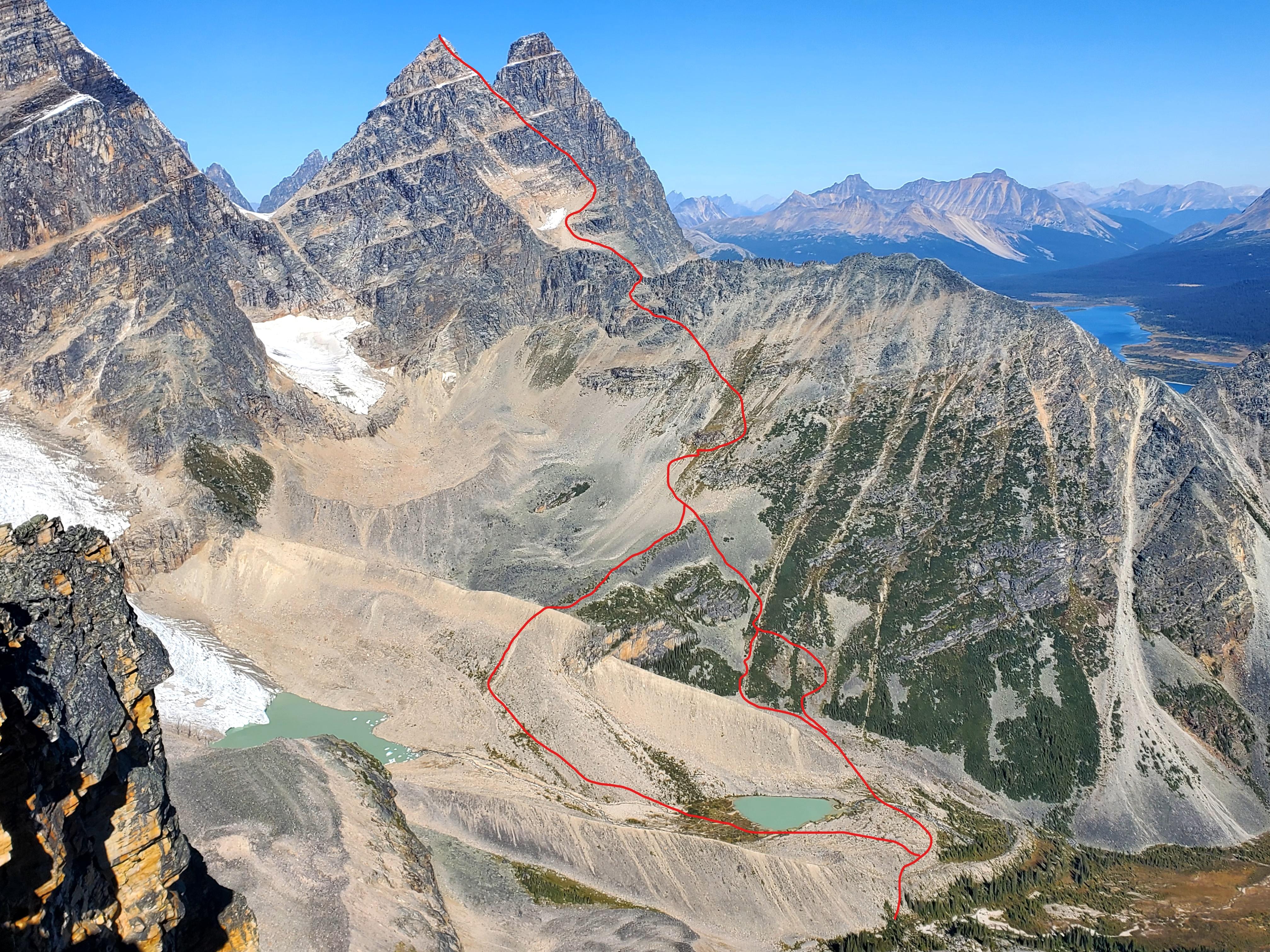
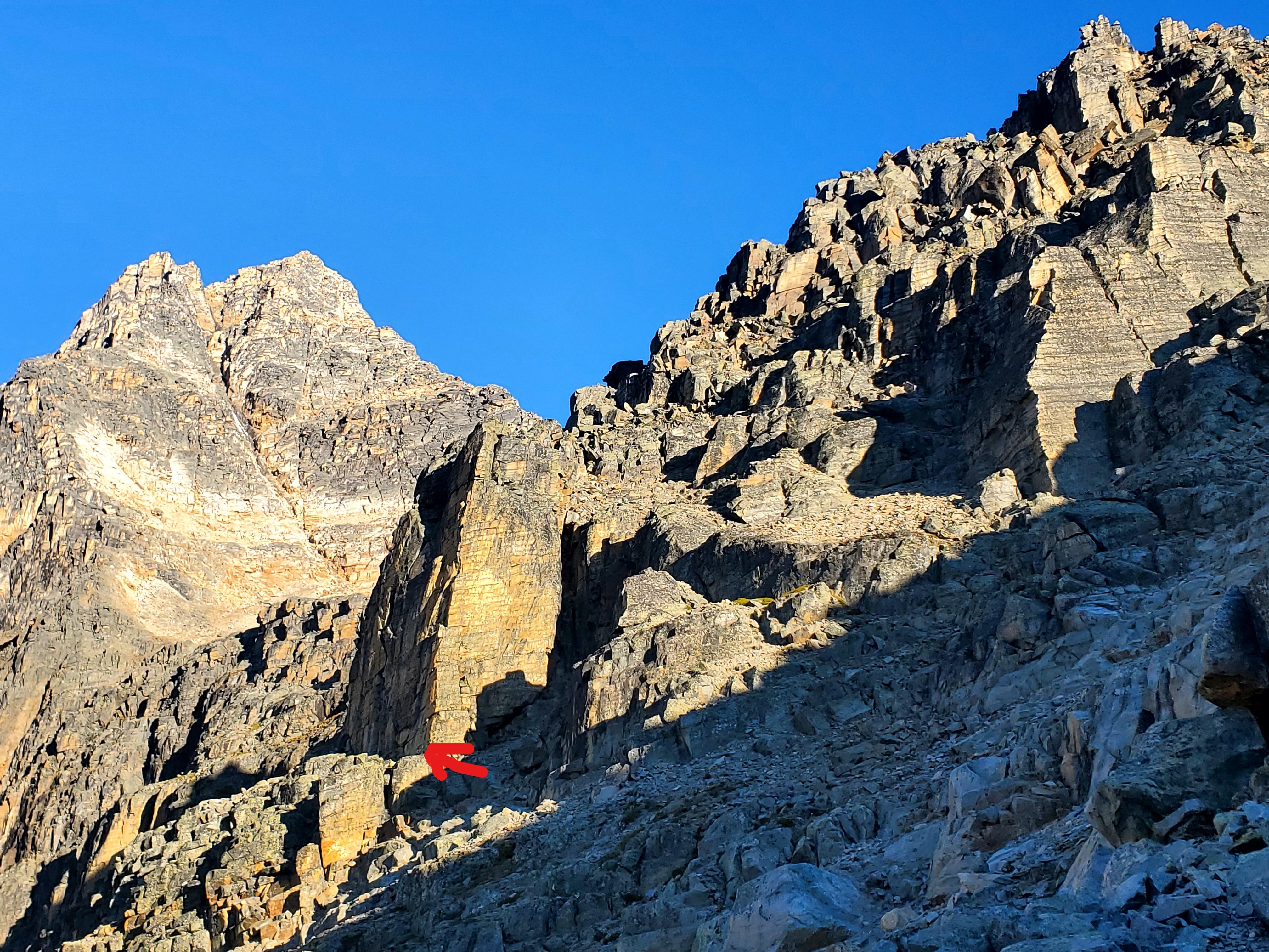
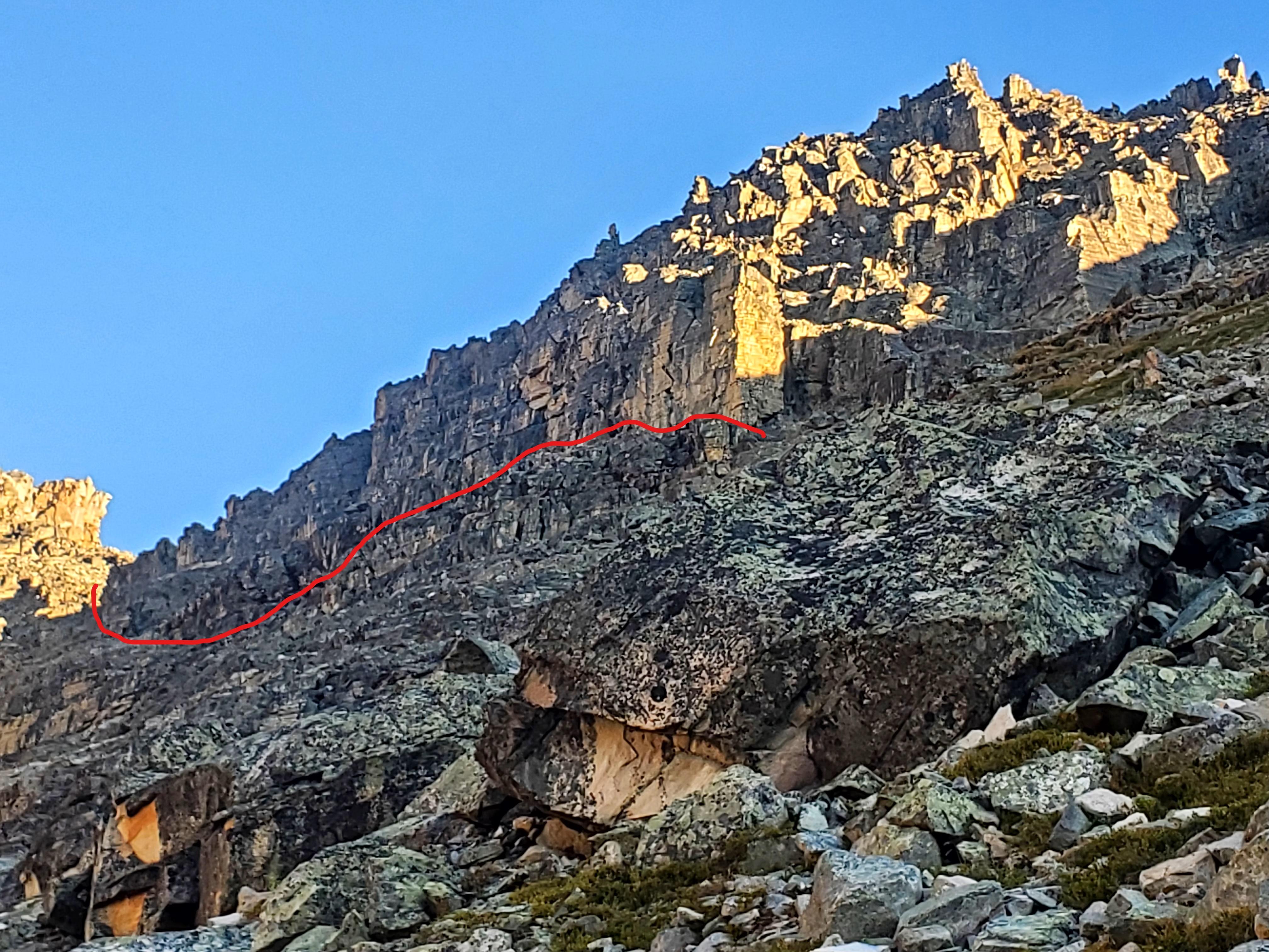
On Sunday we climbed Paragon Pk, crossing the river below the lower lake of Bennington/Parapet’s east glacier in the morning, and above the lake in the afternoon with high water. A party the day before was turned back by the gendarmes and we didn’t care to mess with the glacier on the north side of the ridge, but I found an excellent ledge system at 2400 m that allowed us to bypass the entire gendarme section on the south side with relative ease.
There were pockets of snow on the upper mountain, but the key climbing was dry and enjoyable. Higher up, the ridge turns into more of a series of ribs and gullies requiring careful route finding on the ascent and descent to reduce the difficulty and exposure. The lowest rappel was a mess of old, uneven, funkily knotted, rat chewed tat but I fixed it up as best I could.
Of note, the SW ridge descent off Bennington looked too dangerous with rockfall hazard, so it seems like climbing McDonnell and descending its south ridge would be the only reasonable way off. That would make for a very long day.
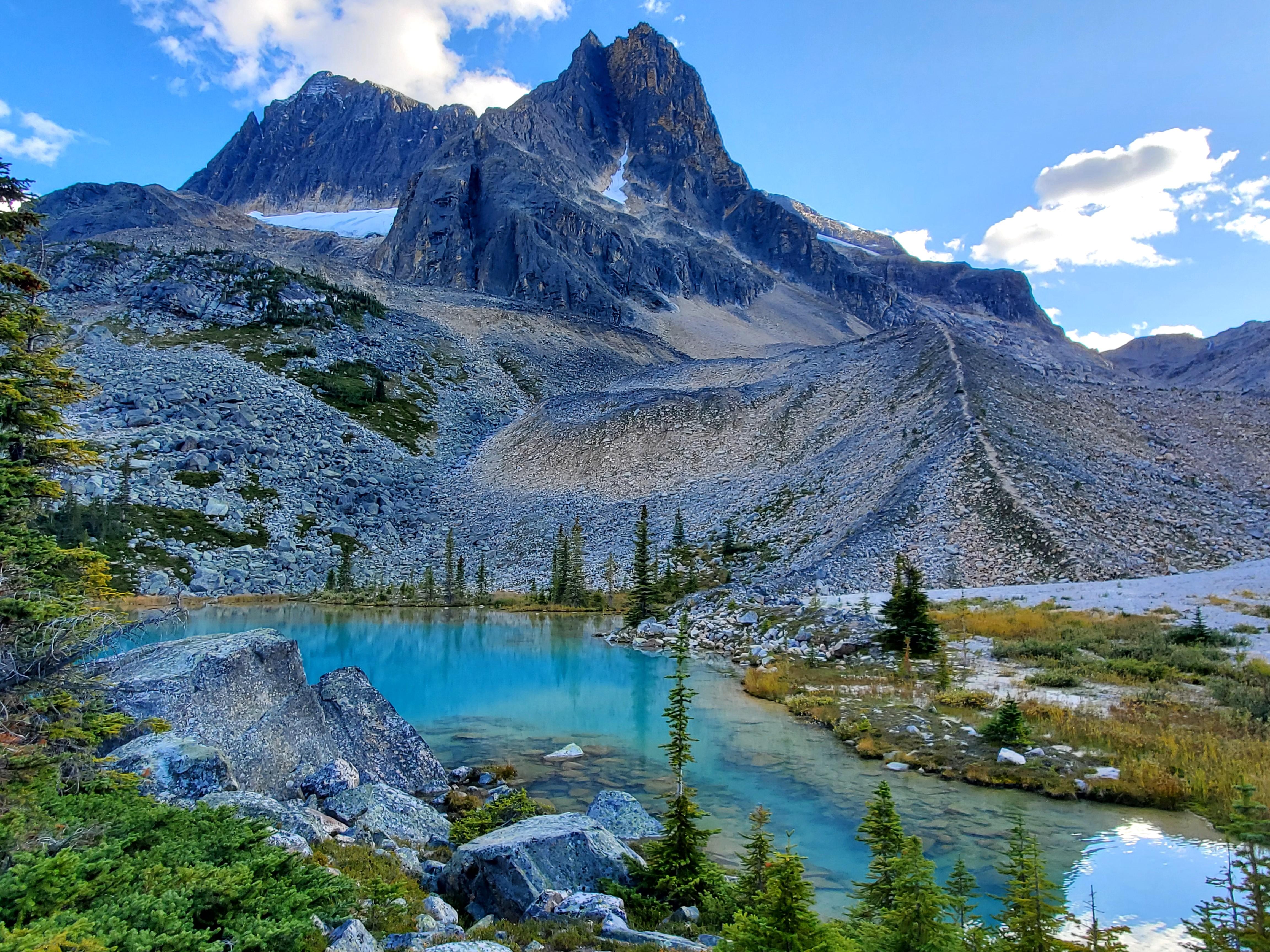
This is such a beautiful zone.
Photos:
1) N. Buttress of Outpost
2) 2nd tower on the N. Buttress
3) Memorial
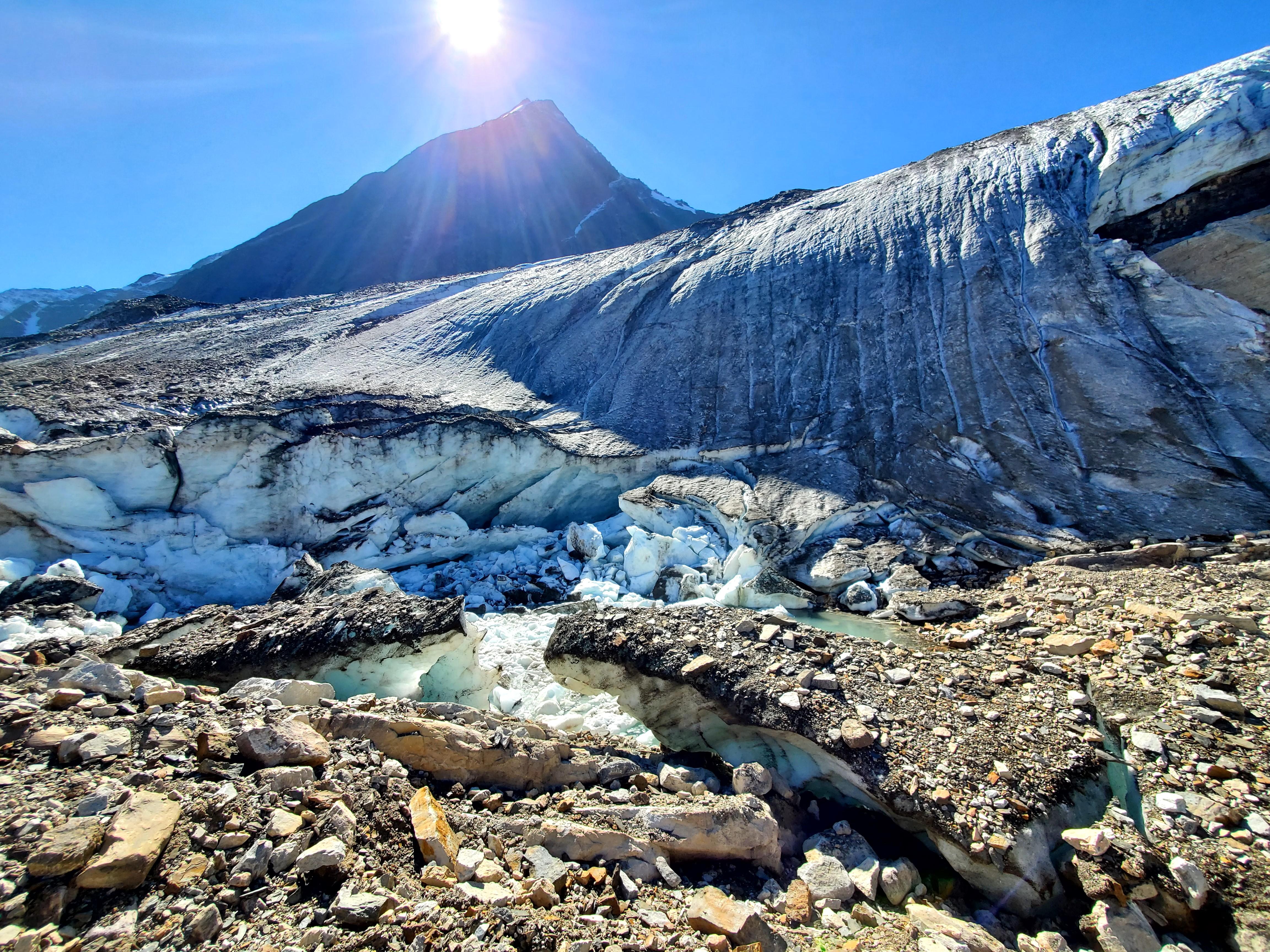
4) Eremite Glacier toe
5) Outpost and Memorial
6) Routes on Paragon
7) 2400 m gendarme bypass on Paragon
8) Gendarme bypass from afar
9) N. side of gendarmed ridge with glacier
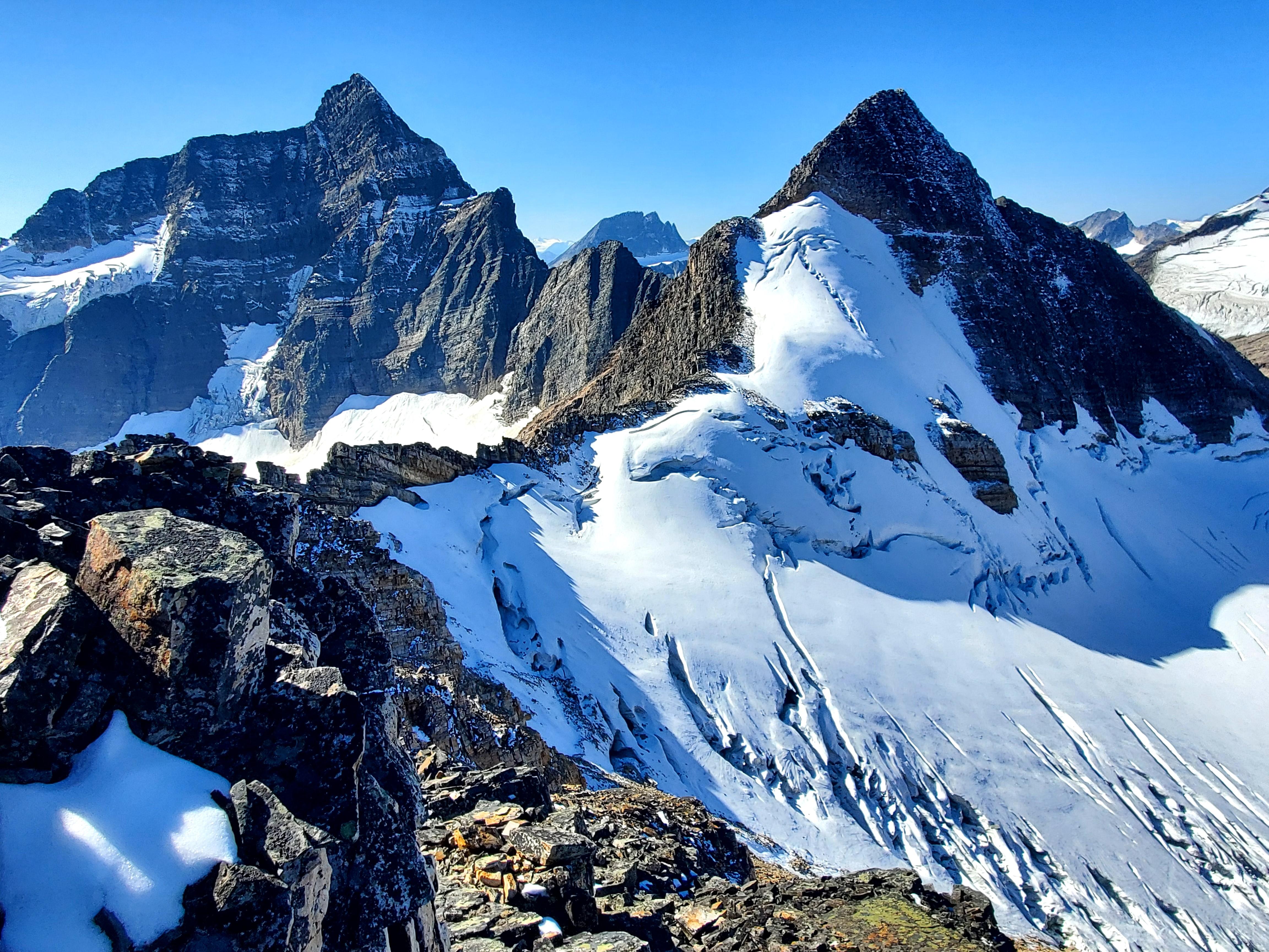
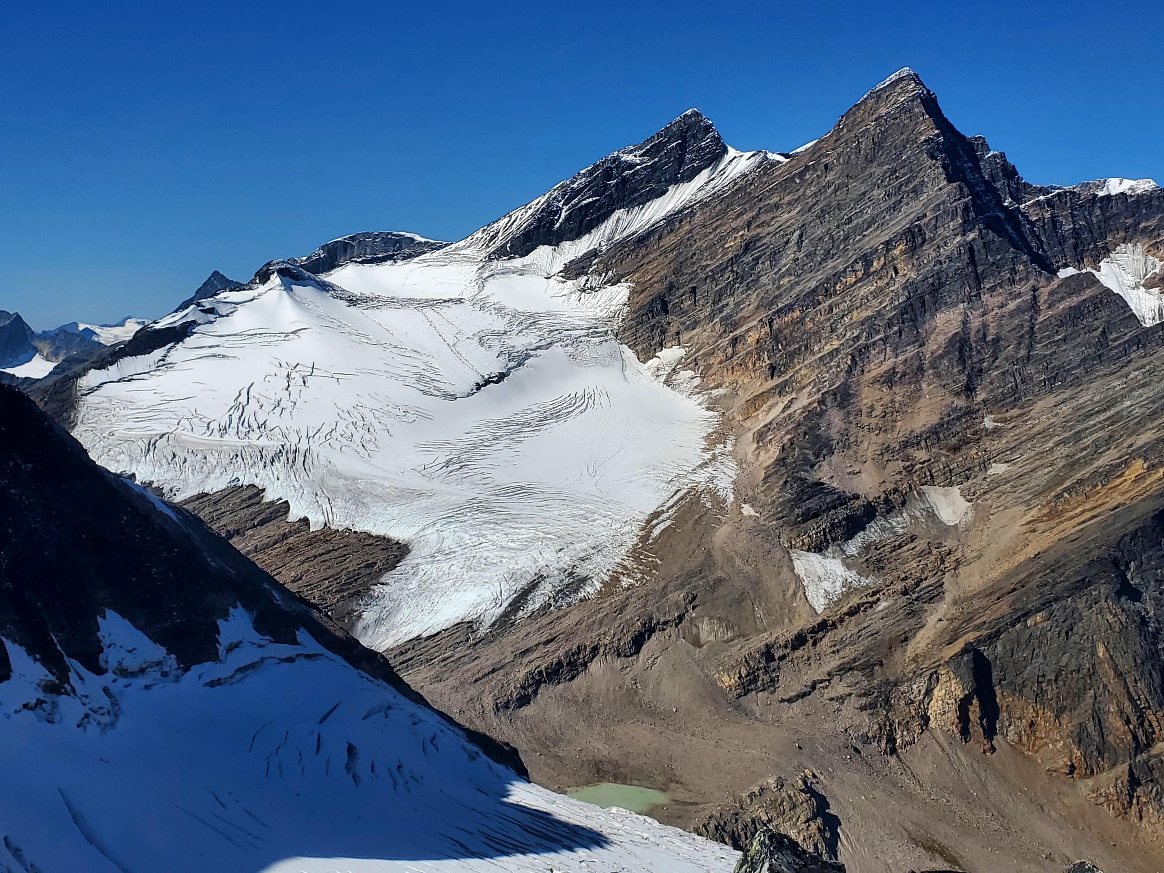
10) Bennington, McDonnell and Fraser glacier
Shaun King
ACMG/IFMGA Mountain Guide
Yamnuska Mountain Adventures