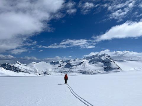
Ski and travel conditions from the April 21-28th Apprentice Ski Guide Exam
Wapta Icefield and Lake Louise area
Weather: Our ski week started with unsettled conditions with strong to extreme variable winds in the alpine; this resulted in significant wind effect in exposed terrain. Visibility improved over the middle of the week with no precipitation though crusts were formed on solar aspects from ALP to BTL. The latter part of the week saw lengthy periods of flurries with low visibility in alpine terrain; precipitation totaled to around 20 cm of storm snow. Throughout the week freezing levels stayed relatively consistent around 2300-2500m.
Snowpack: Sunday brought 5-10cm on HN with higher amounts in lee features from the moderate to strong westerly winds. Surprisingly we only noted isolated zones of wind effect on high alpine ridges and exposed cols. Significant solar input 22nd/23rd created moist snow that refroze into widespread solar crusts. Friday and Saturday brought another 5-15cms HN later in the week refreshing ski conditions above 2200m. Daytime freezing levels rose to ~2500m with limited overnight recovery TL and below created moist snow on all aspects BTL and into lower TL areas. Polar aspects above 2200m were the best bet for finding the best ski conditions throughout the week.
Avalanche Activity: Despite periods of good visibility and five groups spread from Highway 93S (Whymper) north to the Wapta, we observed little avalanche activity of significance. On Monday April 22nd, we observed widespread loose dry activity to size one from steep solar extreme terrain. We also observed several size one wind slabs from similar easterly terrain. These avalanches occurred during the storm with the HST running on the newly buried crust. Through the remainder of the week, we observed a few loose dry and loose wet avalanches to size 1 from extreme terrain. These were associated with solar input on rocky features in the afternoons. None of these avalanches resulted in step downs to the persistent and deep persistent weak layers in the snowpack. We observed isolated evidence of previous persistent slab avalanches, notably on the east face Mt. Des Poilus and the south face of Cirque Forepeak. These avalanches are now over a week old and were the only evidence that we observed of this avalanche problem.
Other Hazards: Crevasses were a concern with variable coverage on the ice ranging from 50 cms to 300+ cms depending on terrain features and exposure to wind. There are large amounts of visible crevasses and sags including new ones along well travelled routes (Olive/St Nic Col, Balfour High Col, Mt Gordon, Chimney Glacier). Cornices appeared to average size and we did not observe any notable failures this week. Low coverage and variable surfaces TL and below present difficult travel conditions most notably BTL and at most elevations on solar aspects. The Bow Canyon has open water and became isothermal in the early afternoon with warmer temps. Other parties reported some small rock fall in the St Nic area as well as serac fall in the Balfour High Col from the previous week. Challenging visibility limited direct observations.
Terrain and trips: we travelled in steep, complex glaciated terrain on the Wapta and around Lake Louise. All aspects and rode mainly non-solar slopes up to 40-45°. We minimized travel treeline and below due to dangerous travel conditions.
Objectives from the week included: Mt Rhondda, Mt Olive, Mt Habel, Collie Icefall, Little Crowfoot, Mt Gordon, west Gordon traverse in both directions on the Wapta and in the Lake Louise area Whymper North, Divide Creek - Niblock/Whyte col, Cirque Peak North couloir, Cirque forepeak, Mt Hector to just below the col and the Chickaboom traverse.
Overall a great week with some decent conditions in the Alpine.
Have a great spring!
Mike Adolph, Marc Piché, Mike Koppang, Craig McGee, Geoff Osler and the ASGE student group.

