The Rundlehorn climb sees a ton of traffic with multiple parties on every good weather day. With the addition of MacLab Slab, Gold Rush and Sunriser, there are a lot of folks out there and everyone is rappelling—either the route they climbed or the next one over. People rapping over each other slows everyone down, increases the risk of rockfall onto others and makes COVID distancing hard at shared stations. Additionally, most parties will take as long or longer to descend than to climb their route.
There is a walk-off option that involves a bit of scrambling and gains another 150 m of elevation but most folks will be able to descend this way in about an hour versus two to four hours of rappelling, and save all climbers a lot of grief and exposure to rockfall.
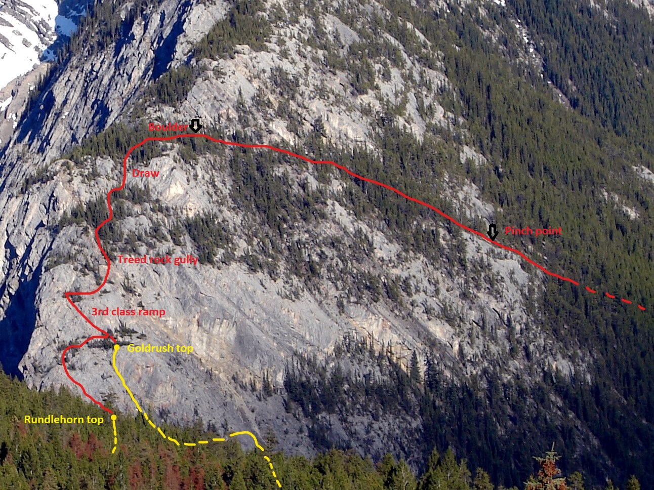
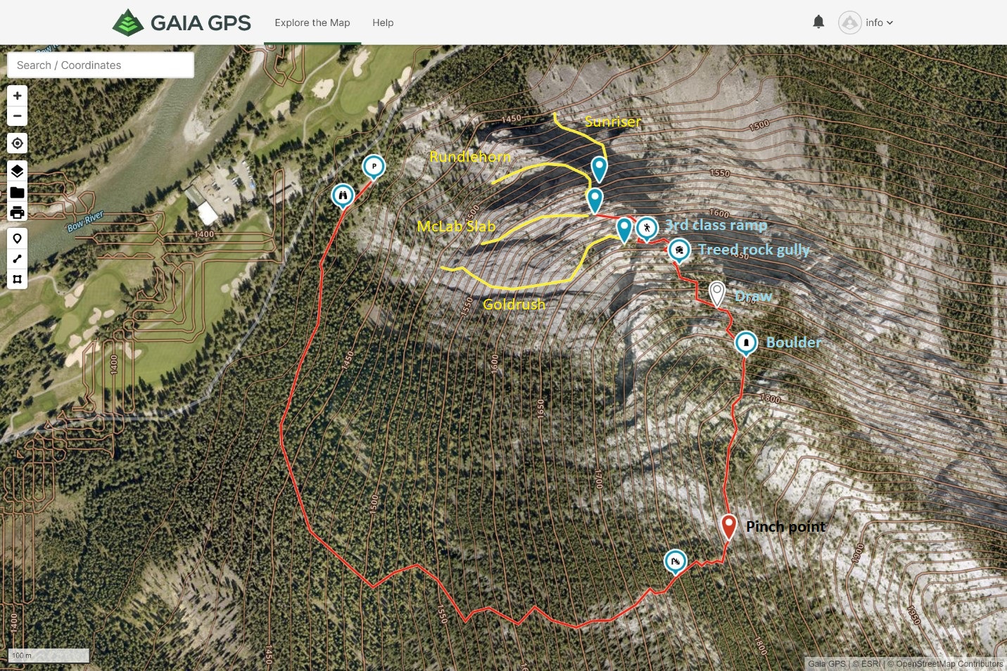
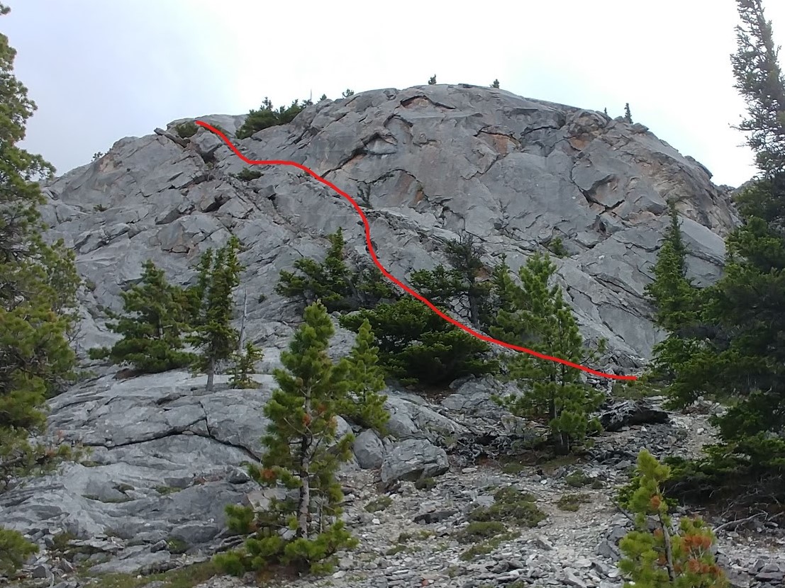
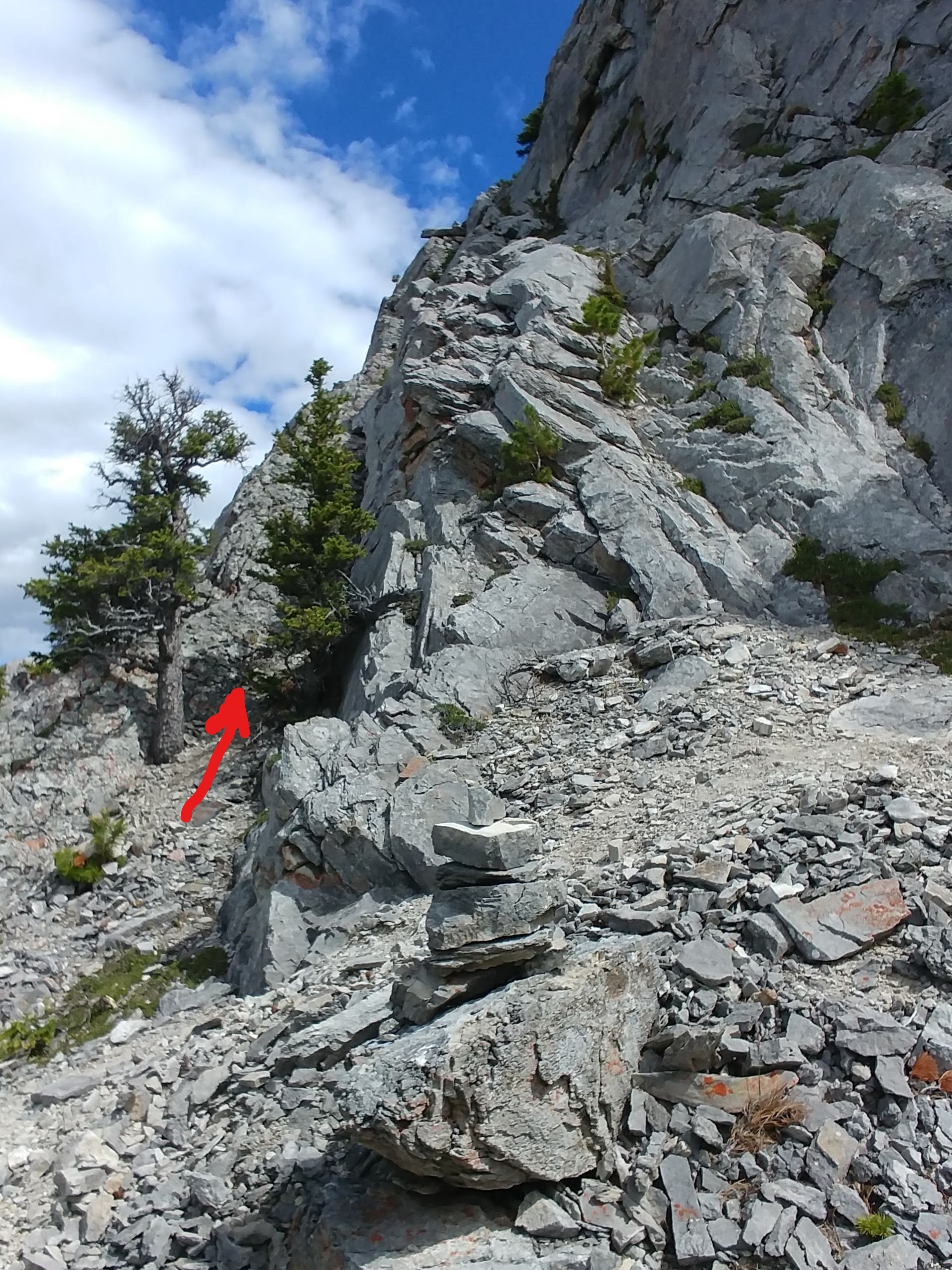
From the top of Rundlehorn, diagonal up and left, scrambling up some low angle rock to gain flatter terrain and follow cairns back right until below a sizable steep face. The Gold Rush climb finishes just below this face on climber’s right. Follow a 3rd class ramp (see photos) up and left across this face to break through to easier terrain above. Head back right following cairns that lead up to a steepish treed gully filled with slate-flat rocks embedded in the earth. Bypass this low on the right through trees to gain easier terrain above and eventually an obvious draw with gravel in it higher up. Immediately above the draw go hard right past trees to gain a rock rib that leads up to a flattish bench below the next big steep rock face. Locate a large boulder with a cairn on it, in a small clearing in the trees @ GR 02096932. This is the landmark to start traversing south. Start just beneath the steep rock and gradually diagonal down through spaced trees until rock slabs force you down through a pinch point between the slabs at GR 02076910. All grid refs are NAD 83.
After this, diagonal out descender’s left to where steep scree slopes lead down to short section of dead-fall. Diagonal out left again to link up more scree slopes which lead to lower angled open forest and eventually a trail system below 1450 m that leads north back to the packing lot. ~1 hr.
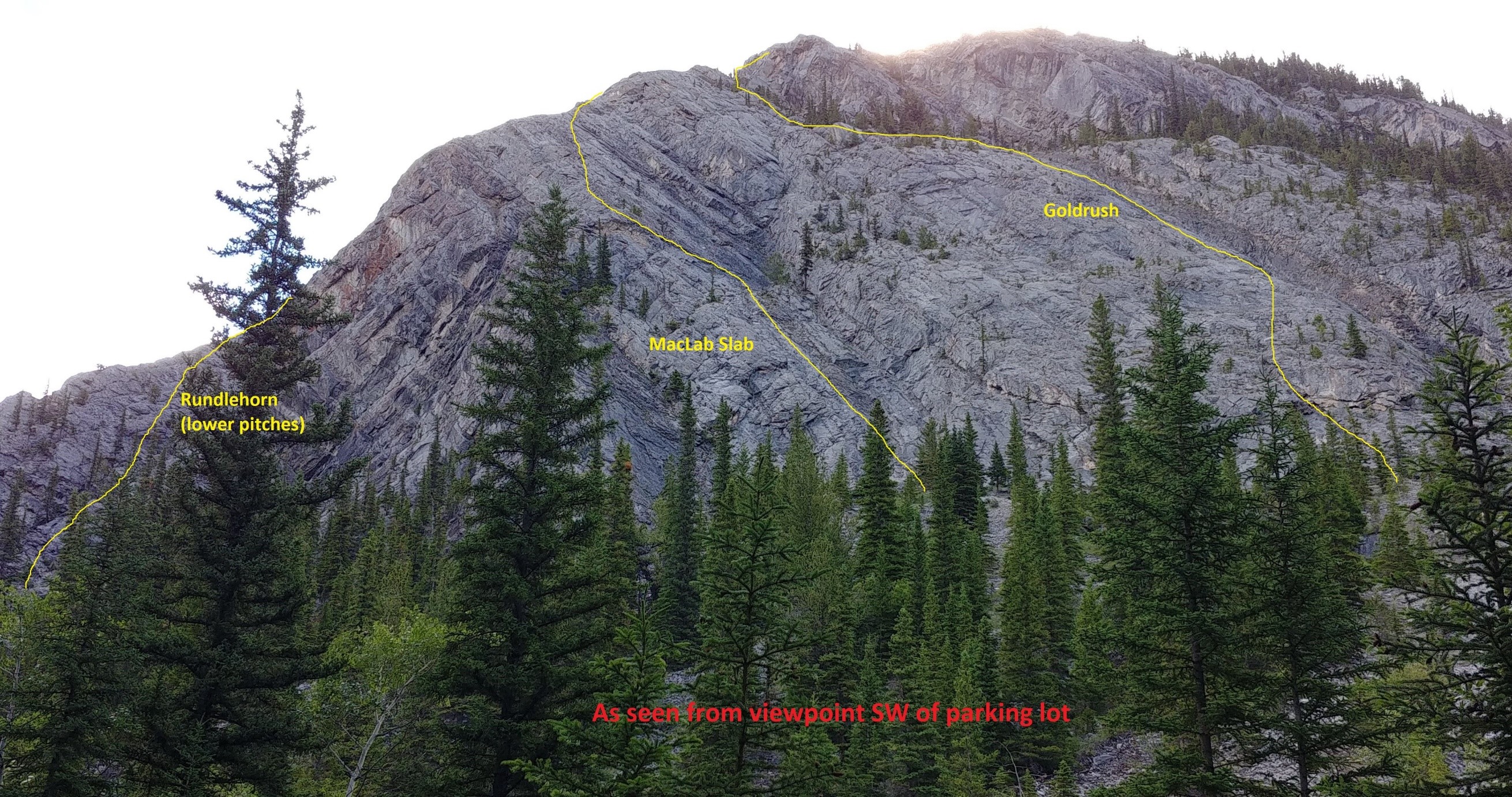
If you are climbing MacLab Slab or Gold Rush it is a good idea to walk SW from the parking lot on a trail for 40 m to a viewpoint (see photo) where the trees open up and you can see both climbs. If you can see a party already on your intended route, it is advisable to pick another objective as these climbs have a lot of loose rock.
Play safe and enjoy the climbing everyone!
Cheers,
Shaun King
ACMG / IFMGA Mountain Guide