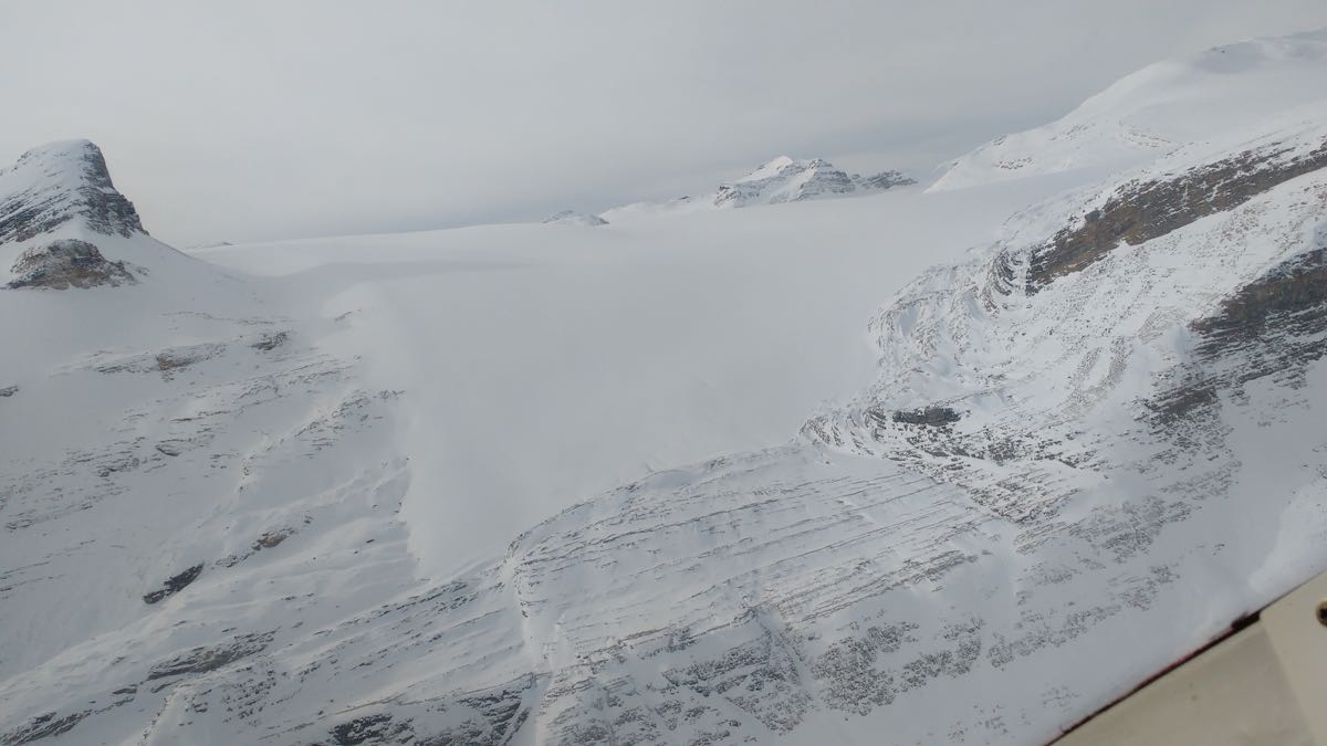
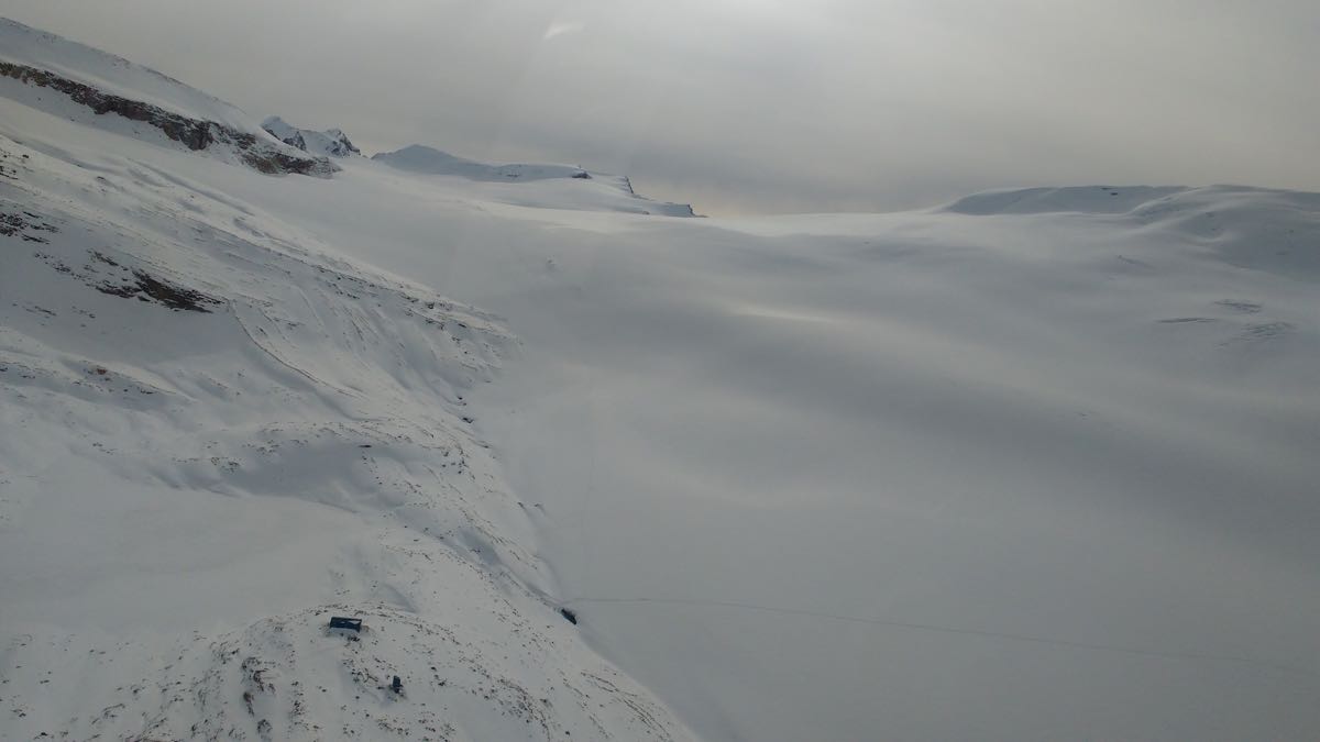
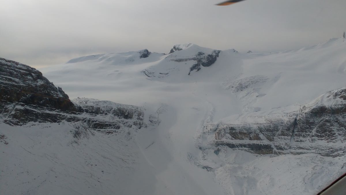
Parks Canada Visitor Safety had a flight today from Saskatchewan River Crossing along the divide through the Wapta Icefields, Lake Louise region to Banff.
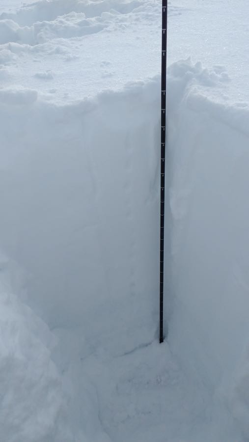
A snow pit was dug on glaciated terrain at 2700m just North of the Wapta Icefields (photo attached). A very well settled snowpack of 100-120cm was found in this location with no significant shears. For October coverage on the glaciers is excellent but there are many crevasses still open or thinly bridged. At tree line the snow tapers off dramatically.
Previous avalanche activity to size 2.5 was evident from the storm a few days ago, although not widespread. In very isolated areas high in the alpine slabs up to 1m deep were seen. The biggest ones seemed to be at the base of steep, alpine faces where more snow has accumulated due to spindrift. The bulk of activity though was loose dry sloughing in the size 1-1.5 range out of steep terrain.
Ice climbs are still in early season shape in the alpine and non existent at tree line and below. For alpine climbers most of the big faces look out of shape for the short term with all the new snow lingering around on the walls.
We had technical problems publishing a bulletin today but would rate it as follows for Sunday in the regions seen:
Alpine:"Low"avalanche danger with the main problem being loose, dry avalanches in terrain traps such as gullies and steep faces, possible to size 1.5. I wouldn't be surprised to see very small wind slabs in isolated areas.
Tree line and Below tree line: still below threshold in areas observed. Most below tree line areas still are dirt.
We hope to have the technical difficulties sorted by the end of the weekend and will be publishing regular avalanche forecasts starting in early November.
Photos are of the slopes above Bow and Peyto huts.
Cheers
Parks Canada Visitor Safety
Banff/Yoho/Kootenay National Parks