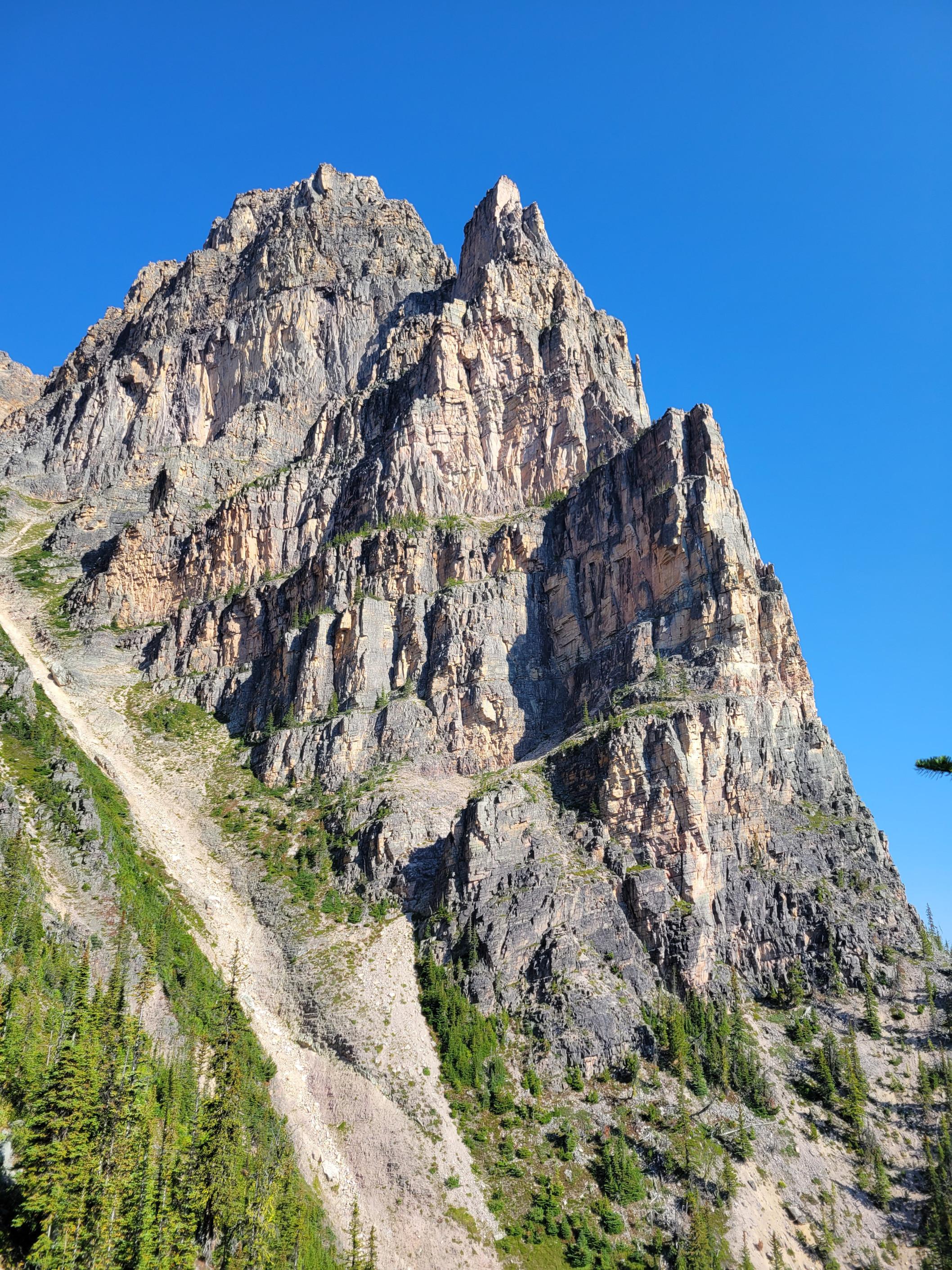
Dragon Peak SE Buttress
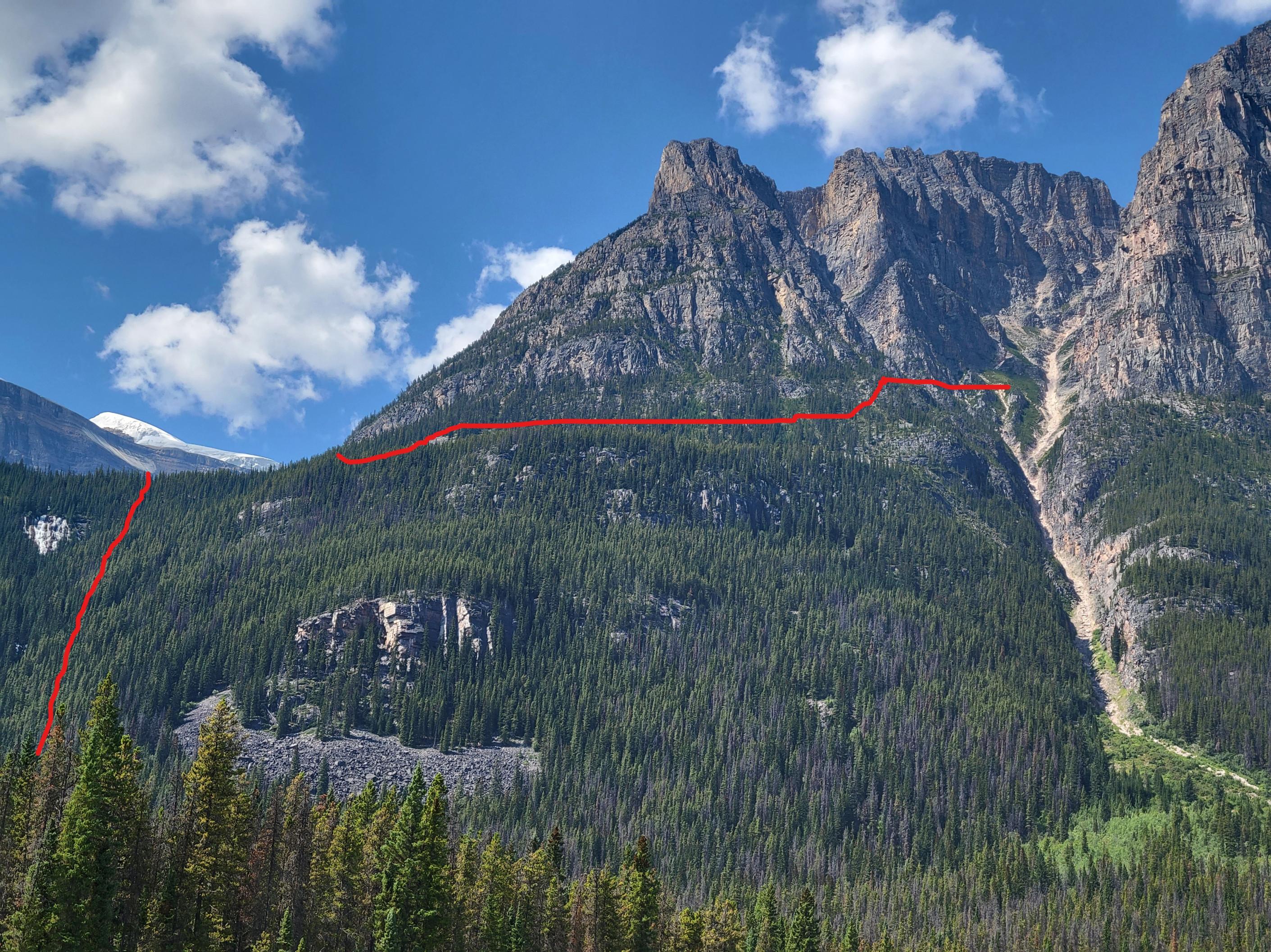
Craig Hartmetz and I attempted the South East Buttress of Dragon Peak in Jasper National Parks this weekend. We approached with mountain bikes from Sunwapata Falls. At the junction with the Chaba Warden Cabin we left our bikes in the woods and utilized a large island to wade most of the way across the Athabasca River. We brought a packraft to ferry packs and people the last 30m of the river into the creek outflow we planned to ascend. We stayed to the climbers right of the creek and bushwhacked up to the lake to the south of Dragon Peak. The bush was dense in spots and a cliff band near the top needed to be navigated but it was all manageable with the right attitude. We built a bivy pad in the talus on the edge of the lake. 4.5hrs from car to lake
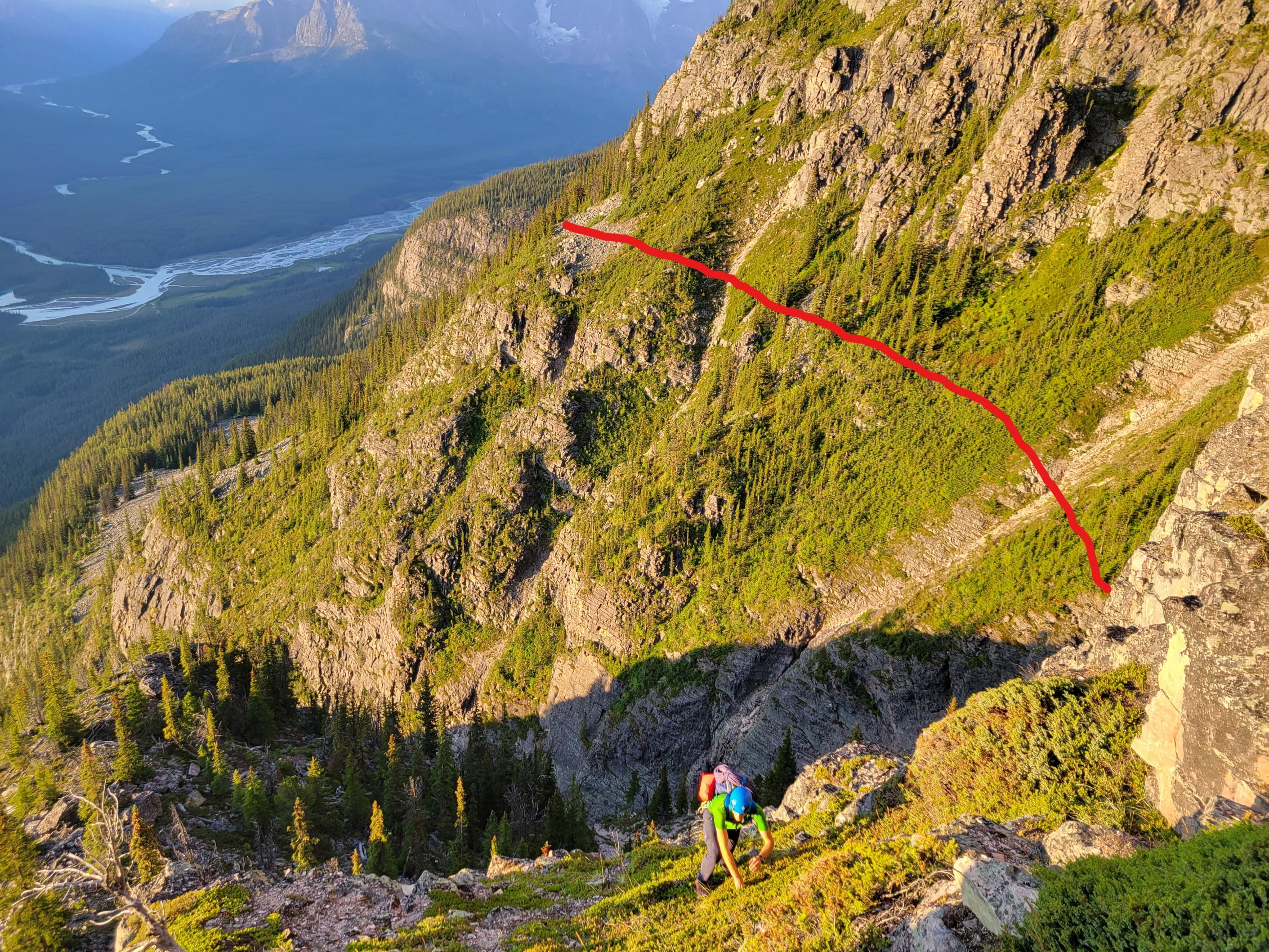
In the morning we contoured under cliffs from the lake towards the SE Buttress of Dragon Peak. Just before the main drainage below the SE Buttress you need to climb up through a weakness in the cliff bands above you in order to access the drainage on steep vegetated terrain. If you are too low you end up above a sizable cliff. 2hrs from the lake to the buttress.
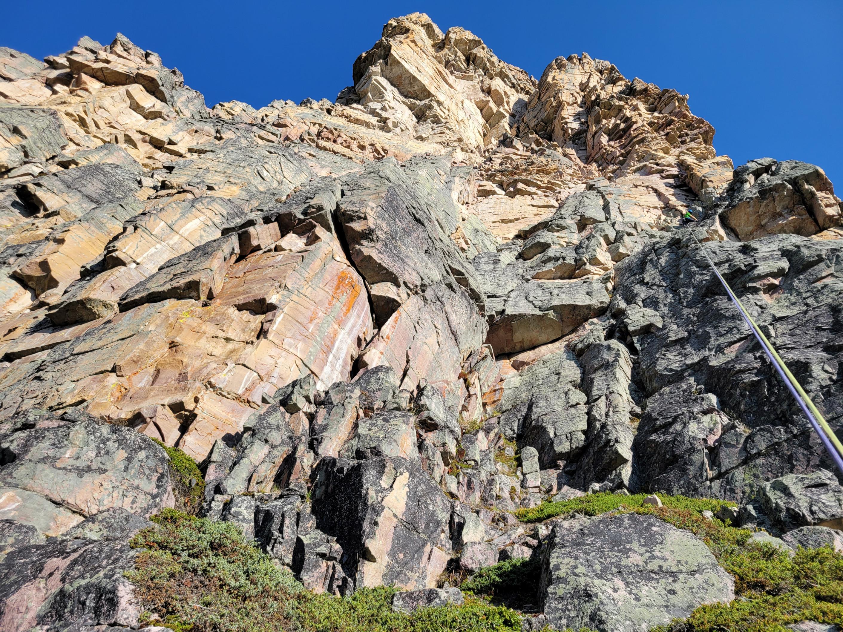
At the base of the SE Buttress we scrambled the first 30m and started climbing the main weakness in the middle of the face. The climbing ended up being deceivingly difficult and tedious. We decided to bail while we still could get to the ground and before we climbed ourselves into trouble.
The SE Buttress of Dragon Peak has some exceptional quality quartzite that deserves more exploration and ascents. Just don’t ask me where the 5.5-5.8 climbing reported in the guidebook is. Your guess is as good as mine ¯\_ (ツ)_/¯.
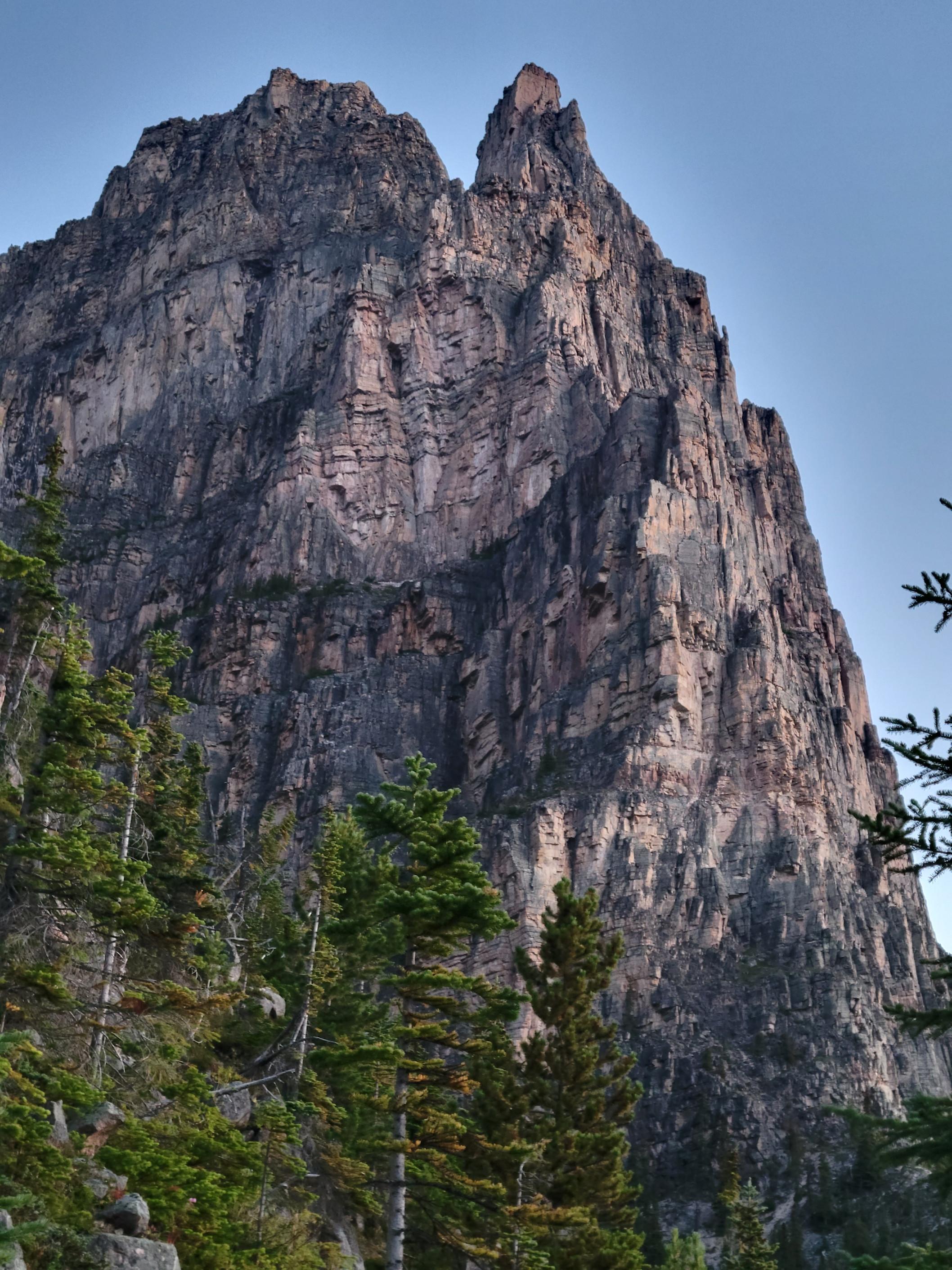
Attached are pictures of the buttress, looking up from the base and a photo of the approach with red lines marking the general terrain we used for access.