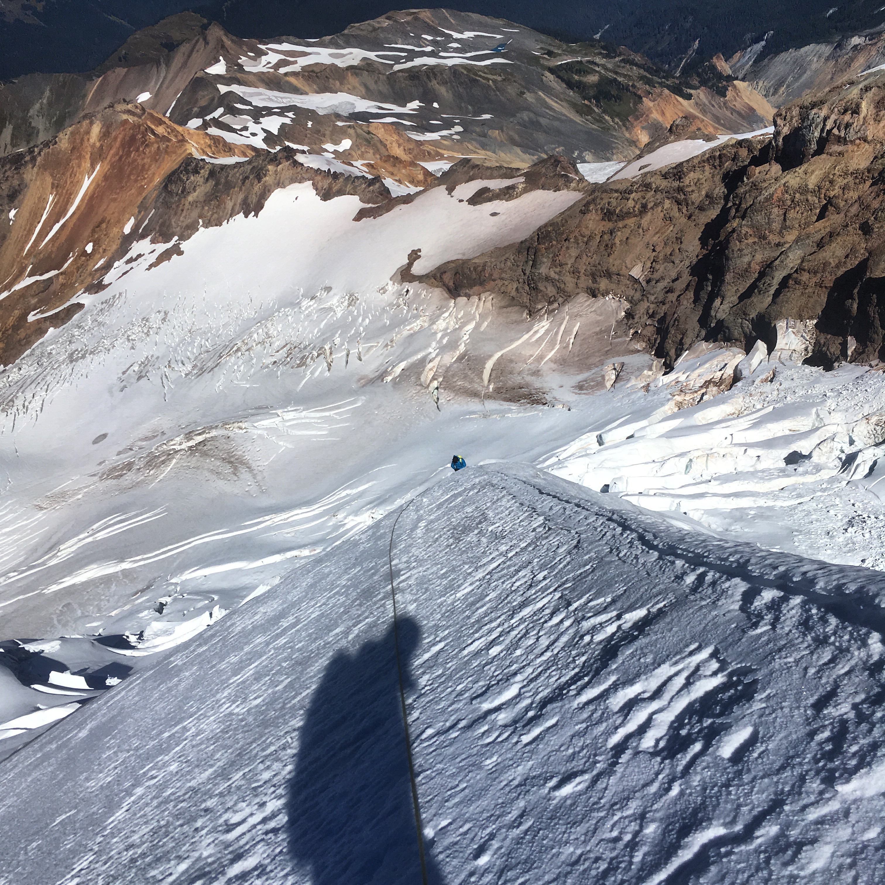
I climbed the North Ridge of Mt Baker over two days with one guest, and found the route in fine late-season conditions. We approached via crossing the Coleman Glacier low and ascending the Coleman-Roosevelt Cleaver, then stepped back onto the Coleman Glacier to reach the ridge. There were plenty of running water on the cleaver to its top. This late in the season I prefer to climb the full, direct North Ridge, accessed by snow bridges or crossing a small moat at the toe of the ridge at 7800'. 600' of snowfields and a short scree traverse regains the ridge at 8400' and a beautiful bivy site. A tent is advised as protection against the aggressive snaffle-hounds (aka wood rats), and the running water there has refrozen for the winter, so bring extra fuel to melt snow.
Steep snowfields with 1-3 inches of consolidated snow from last week's storms leads to the technical crux of the ridge, 55m of alpine ice that we found in brittle but fun condition. Above that was 120m more of 1-4 inches of consolidated snow on top of ice that we chose to pitch out, until the consolidated snow grew deep enough (now up to 6") and the ridge angle kicked back enough to walk across to the next hurdle, 60 more meters of steep snow, then traversing underneath the summit dome bergschrund before crossing a lone bridge at 10,600' and then continuing on to the summit.
We descended the Coleman-Demming Route - last week's storm created amazing conditions and a clean set of steps leads down to Pumice Ridge. A well-kicked in track leads back to Hogsback Camp, but the Hogsback Headwall has melted out to bare ice far enough that I chose to continue traversing across the Coleman 15 minutes further west, until the slope angle kicks back further and makes the bare ice at the bottom more reasonable. Then its a straightforward hike out on trails back to the car, and down to Graham's for the celebratory pint and burger.