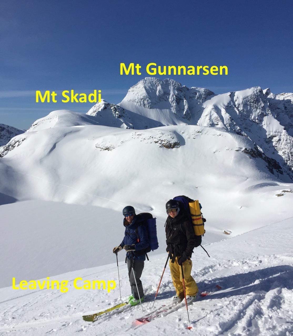
Mt Skadi Base Camp March 13-17, 2021
Gold Range, Monashees. Alpine lake 2 km NE of Mt Skadi

Mar 21, 2021
Skadi Camp
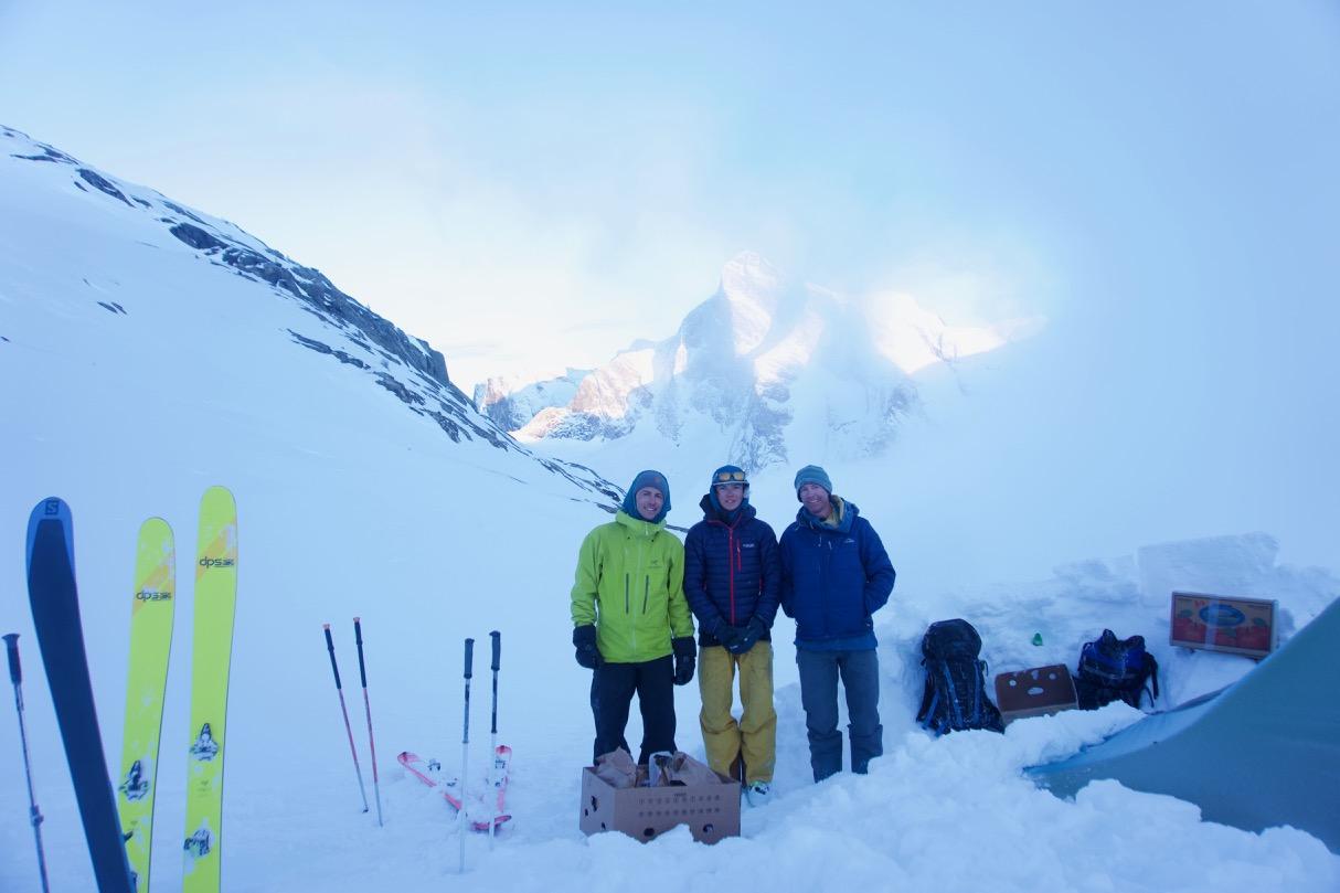
Aaron Cooperman, Seth Cooperman, Titouan Choupin
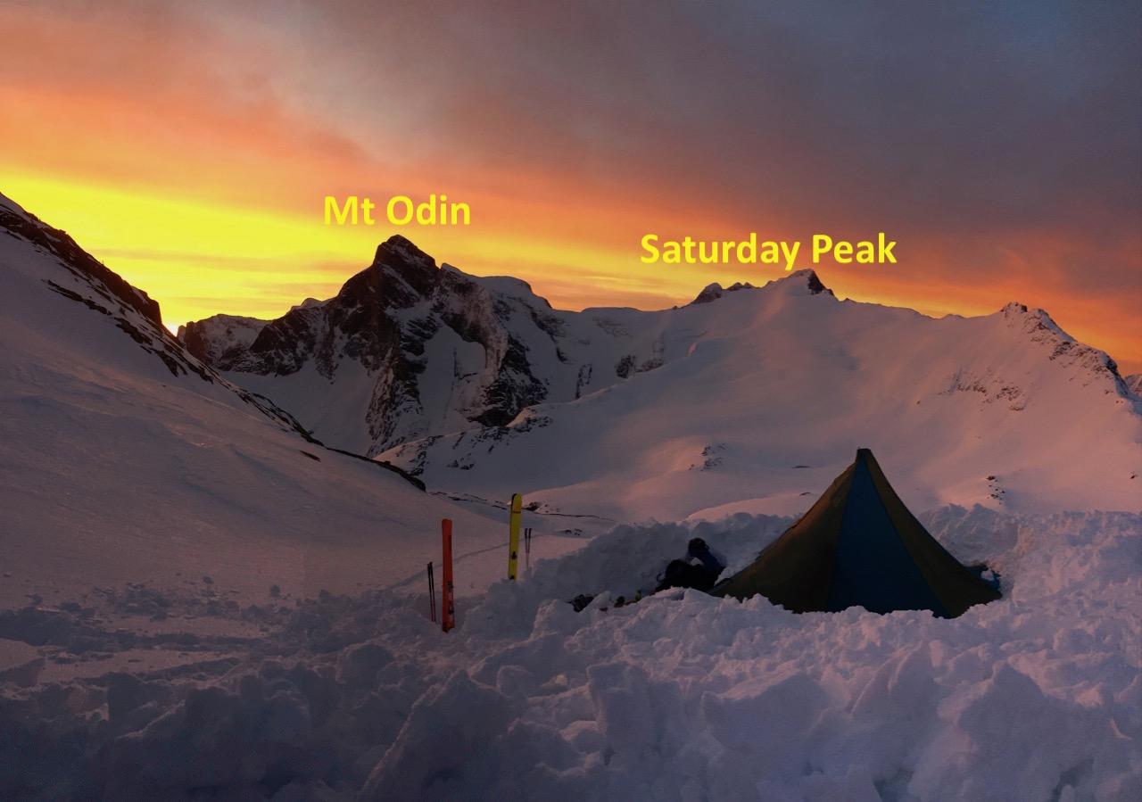
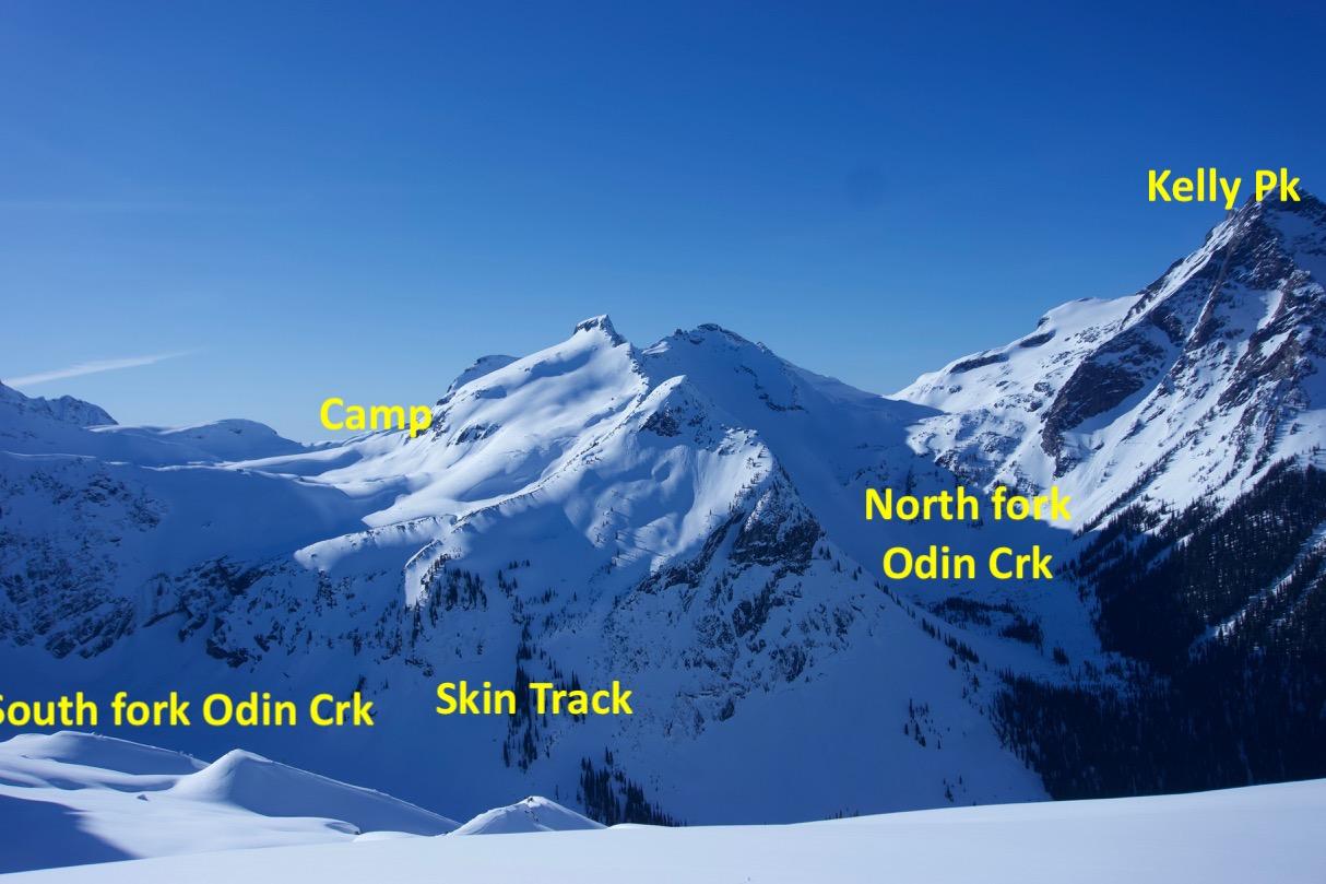
Base camp location at 2300 m S aspect above an alpine lake 2 km due NE of Mt. Skadi - chosen to maximize sunrise and sunset exposure, though the sun seemed to set often before returning to camp !
Accessed by 4 minute heli bump from Sol Mountain Lodge. 12 hour return trip with 23 km of travel on skis.
This location provided access to interesting ski and summit options in optimal conditions, BUT offers very limited options in conditions of poor visibility and high hazard.
WEATHER AND SNOW CONDITIONS
We were flexible to choose favourable weather conditions for the trip.
Temperatures ranged from 0 to a low of -17 deg C on the morning of March 16. Mostly clear skies with 5 cm of new snow on the morning of March 15 followed by afternoon fog below 2300m.
Spring melt freeze conditions on solar aspects. Polar aspects holding dry cold preserved snow providing excellent ski conditions. Snow pack investigation produced only RP results in top 40 cm with no significant weak layers. We had high confidence in snowpack from Infoex reports and our previous obs at Sol Mountain Lodge. Good coverage on glaciers.
Very little avalanche activity - most significant was numerous BTL glide crack releases on solar aspects to size 2.5, one was a direct ob. There are a lot of glide cracks in Odin Creek, and the glide crack above Bearpaw lake released.
Isolated cornice chunks and pillows released - but none significant.
The Dec 7 ice was exposed at scoured ridges and culs, and on regularly cycled un skiiable terrain.
I did fall through a cavity in the snow from a vent hole on the east ridge of Odin. Spooky - this cavity extended at least 30 m horizontal to ridge.
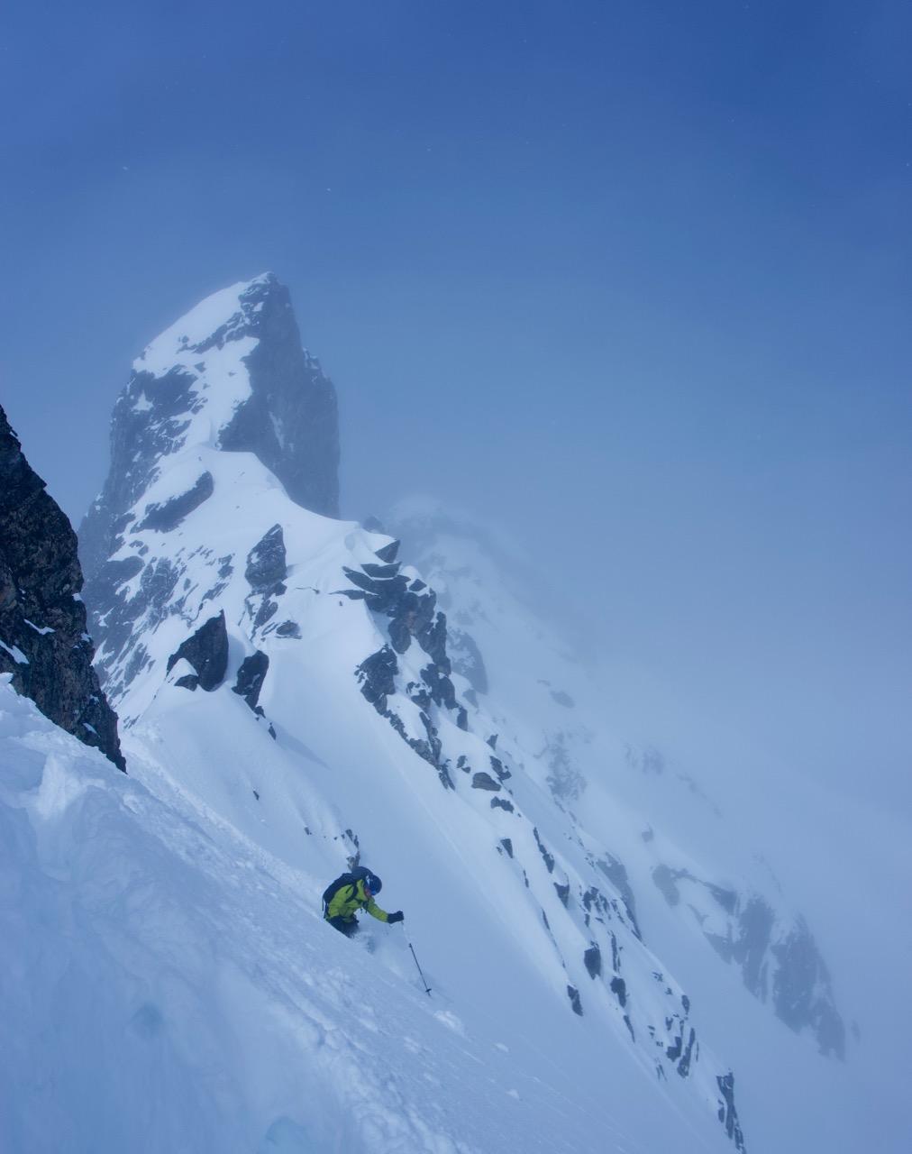
TERRAIN AND SKIING - skied between 1700 and 2850 m mostly north facing terrain in the shadows of Mt. Odin.
March 13
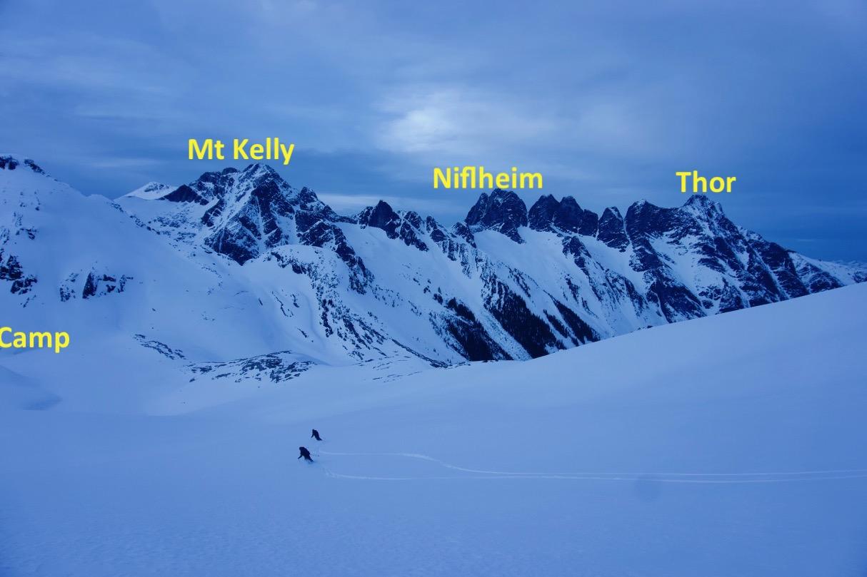
Set up camp and explored ridge at 2500 m above camp with views across north fork Odin Creek to south aspect of Mt. Kelly. And skied on north facing 600m moderate glacier below shoulder of Saturday peak.
March 14
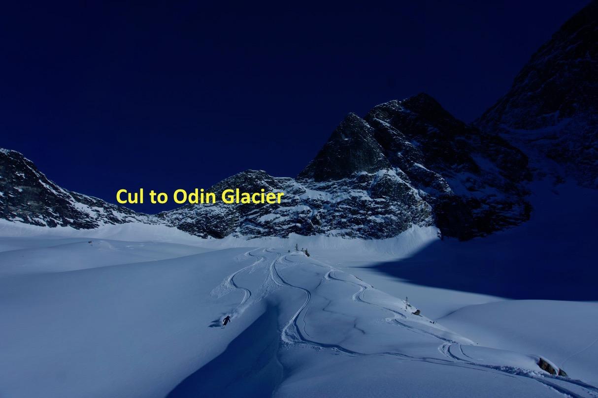
Skied steep north facing glacier from Odin / Saturday Peak Cul into south fork of Odin Creek. Also skiied pocket glacier NW side of Odin, and explored route over cul at 2300 to access Odin glacier. 600 m aggressive ski track back to camp via steep east facing shoulder feature.
March 15
Relaxed day near camp - skiied into E facing basin at head of north fork Odin Creek. 'Explored' ridge NE side of Mt. Skadi in whiteout fog.
March 16.
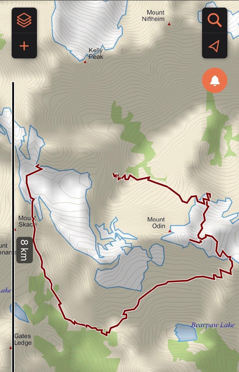
Circumnavigated Mt. Odin (see photo of track). After 16 years looking north to this mountain finally got to visit it on skis. From camp we descended the head of Ledge Creek to lake at 1700 m on supportable crust. Climbed to TL lake at 2050 m and traversed S facing alpine above Bearpaw Lake and gained east ridge the Frigg glacier on east ridge of Odin. Climbed to 2850 m and descended the north facing Odin glacier in cold dry preserved powder. Climbed to cul at 2300 m on west ridge (short rappel on west side) and descended to 1700 m in south fork Odin Creek.
March 17
Skied back to Sol Mountain Lodge (12 hrs, 23 km). Descended gully south east side of Mt Skadi to 2000 m tree line, then climbed and used ridge system to traverse around Icebound Lake to make it through the Gates Ledge. We did not complete the traverse of the ridge system - but bailed down a west facing drainage to the north side of N Caribou Pass. From N Caribou Pass we skied down to the shores of Peters Lake at 1700hrs and back to Sol Mountain Lodge, travelling through familiar terrain in the dark. Damn rights there was beer and food waiting, and showers too!
We have put together a good collection of terrain photos available to share.
Memorable trip - very grateful for the ideal conditions to explore this piece of the Gold Range. What a time.
Aaron Cooperman
Sol Mountain Lodge