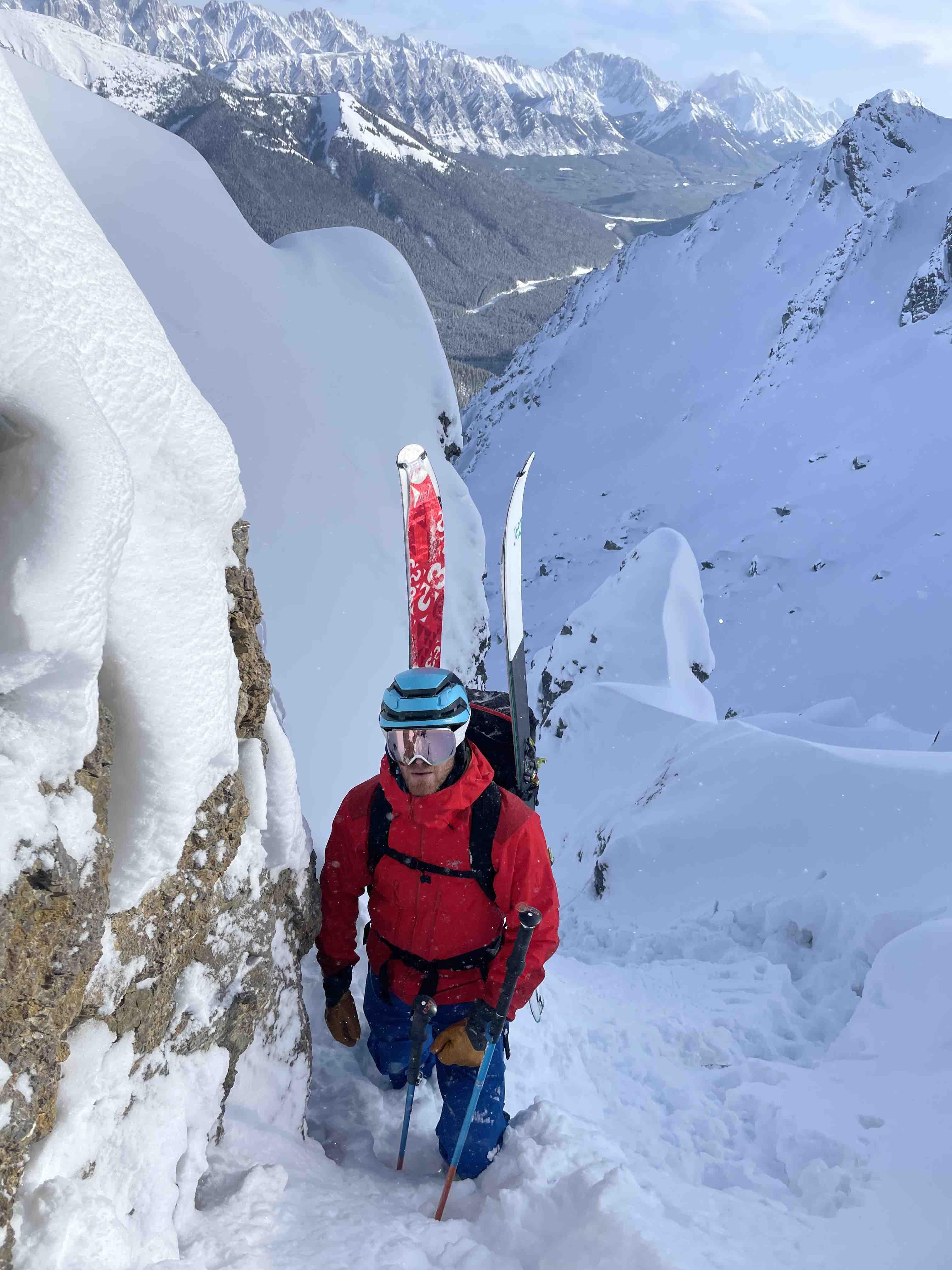
Thursday and Friday (20221201, 20221202) I ski toured in the vicinity of Purple Knob.
Thursday am there was 10cm of new snow overnight, overlying the up to 40cm of storm snow from Nov 24-25. There were a number of skiers, including solo skiers entering the Dogleg Majore from Blacksmith Ridge midway to the summit of Purple Knob (looker's left) where there are two lone larches. The ridge is mostly scoured from last week's wind event with only new storm snow over rock. Although this particular section of the bowl has not slide in the past week, none of the skiers triggered a slab and there was no reactivity in the recent storm snow. There was evidence of a harder slab from lookers right, sz 1 that stopped at the bottom of the start zone, now being covered by the overnight storm. This means that in the past week, there have been 2x loose dry and 1x wind slab in the upper Dogleg Majore bowl running just into the top of tree line. Daytime temps remained in the -20c range with little wind.
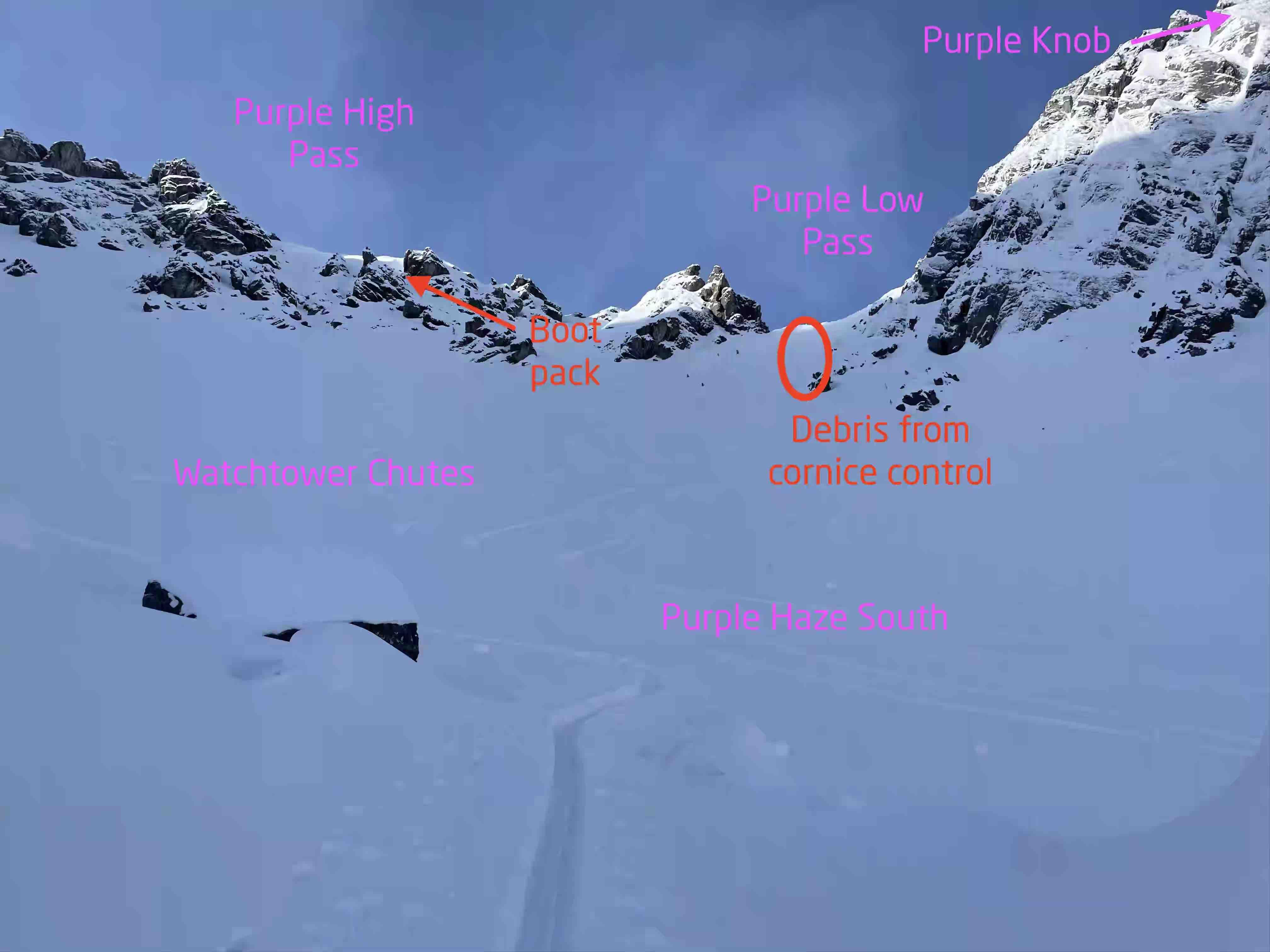
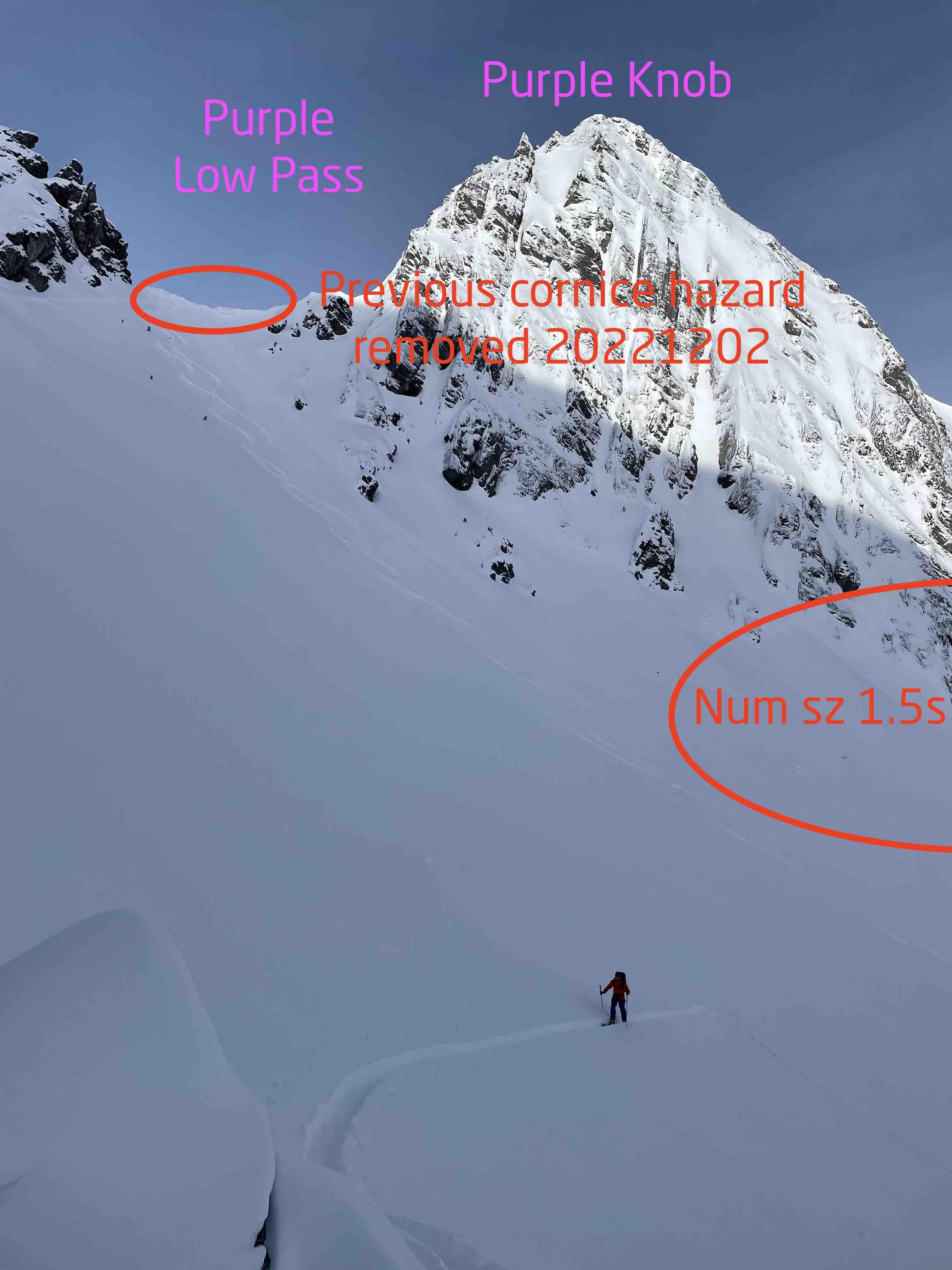
With these observations, I ventured around Blacksmith Ridge Friday into the south bowl below Purple Low Pass. Two small cornices had formed in the past week in the col. There was evidence of a wide spread hard slab cycle off the south face of Purple knob (5-6 sz 1.5s) stopping on a narrow bench mid track. There were no avalanches in the bowl itself. All previous tracks and avalanches were covered by the Nov 24 and Dec 1 cycles. Of note, there were several micro loose dry avalanches stopping in track, which I suspect occurred due to faceting of the Dec 1 cycle and running on the interface with the Nov 24. None of these micro avalanches stepped down into the Nov 24 storm snow. This was my fourth day in the zone in the past two weeks. I chose to set an up track on the right side of the boulder field. This zone is generally 25 degree terrain and similar aspect to the zone where I had a large whumpf on Monday albeit well below ridge top. There was no whumpfing of the buried wind slab in the boulders, which gave me the confidence to set an uptrack to Purple Low Pass. At this time the 50cm of storm snow has settled and is unreactive to rider traffic and to cornice control (I skied and shovelled off the two small cornices) on the buried wind slab. We skied blissful cold powder in the bowl.
As I had skied from Purple Low Pass north twice already, I decided explore higher. I set the skin and boot pack up to Purple High Pass. In the flanks of the lower gully/couloir, there was up to 100cm of storm snow overlaying the hard slab from last week's wind event. There was minimal cracking in the corners, and only in the upper 15cms. The terrain then steepens significantly especially early season before it is filled in. Here the snowpack was between 0-100cm. Basal facets were easily observed to size 3mm (I did anticipate larger facets which I did not find even in the very shallow areas). The hard wind slab appears to be breaking down with the cold temps and the overall snowpack was unreactive. What I expected to be a facet grovel actually packed and climbed quite easily and we were able to gain Purple High Pass. At ridge top, winds were moderate with light snow transport. We skied north down towards the Purple Hero drainage. This is likely the first time this slope has been skied this year. In the upper section, there are still rocks (this zone is notorious for being stripped by the winds). There was ~20cm of storm snow over hard wind press. Mid slope was back to boot top powder. The lower gully run also had boot top powder. The lower skin track was in, likely from parties Wednesday or Thursday, which made the cold snow walk back a bit easier. It was -30c at the vehicle at 0830h and -15c at 1430h. Cold wax was benefical.
I hope everyone has a fun weekend enjoying what was, up to yesterday, largely undisturbed powder. Safe travels!
Brent Peters
PeakSTRATAGEM.com