Greetings folks.
I spent the majority of the past 5 weeks climbing in The Adamant Range (Northern Selkirk Mountains), based from a camp in Austerity Creek.
I’ve attached a few relevant photos and accompanying information below for those still considering heading into the area this summer:
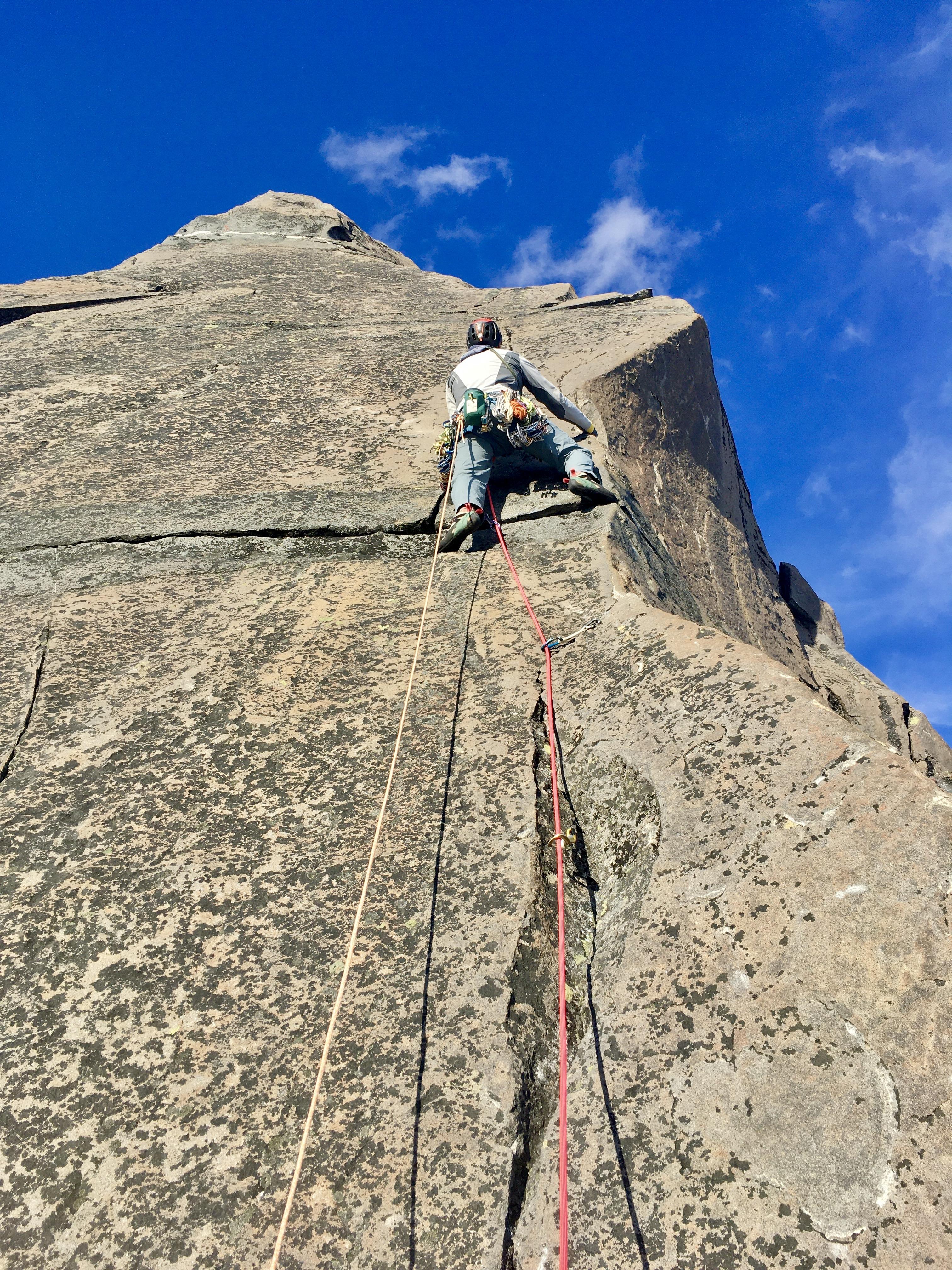
1. Impeccable rock around 3000m on the SW Buttress of the Ironman (photo from July but conditions are still the same).
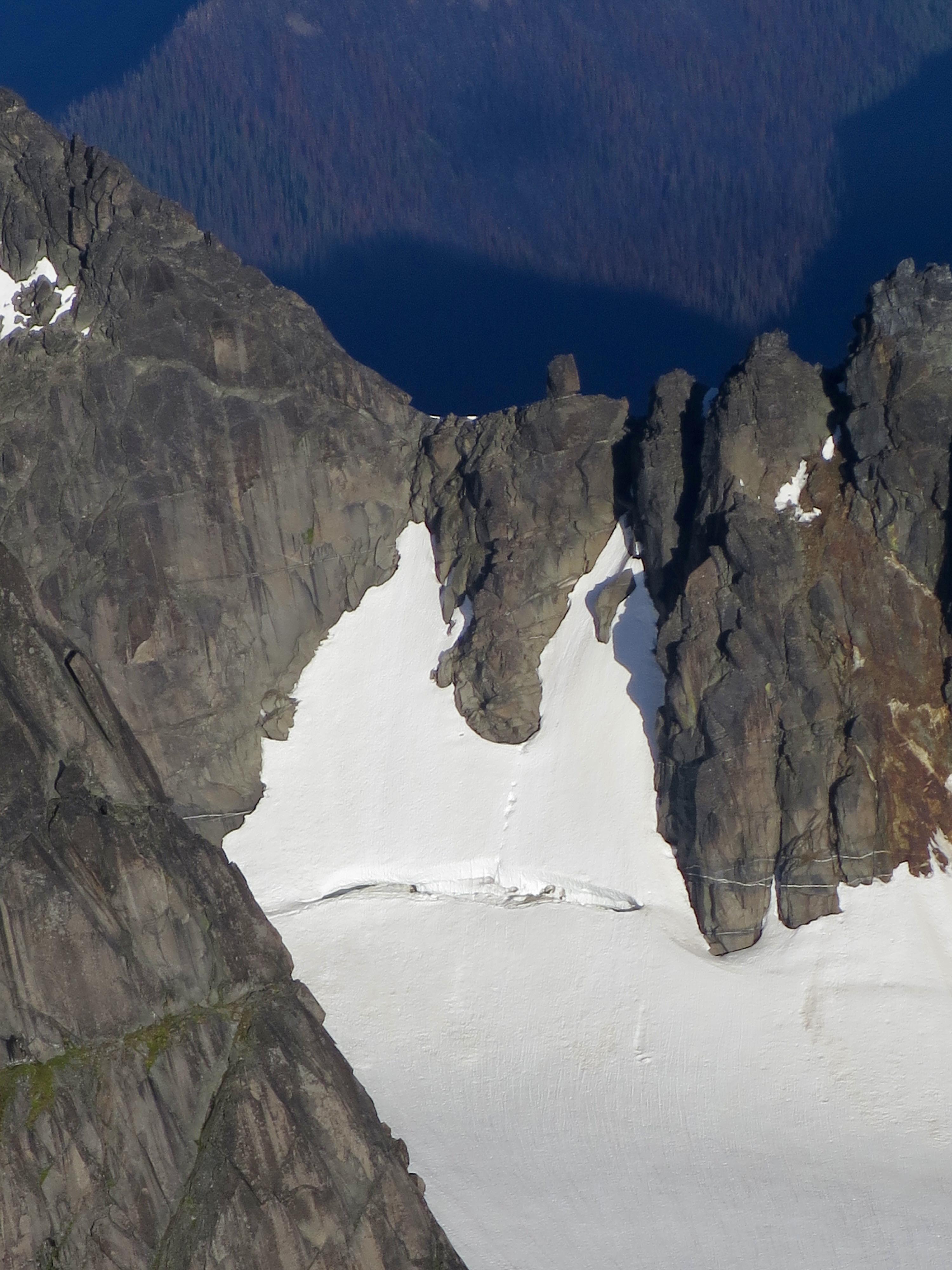
2. Old photo (July 22nd) of the Adamant-Blackfriar Col taken from The Ironman. Glacial recession has resulted in this being very steep and loose for the first few 5-7 meters. I tried 4 different routes and bailed on each one due to either steep and wet rock, down-sloping jenga-blocks, precarious rope cutting flakes that were difficult to climb around, or scarcely protected slabs (I didn’t have rock shoes with me). I’m not saying it’s impossible, just be prepared for more than an easy scramble.
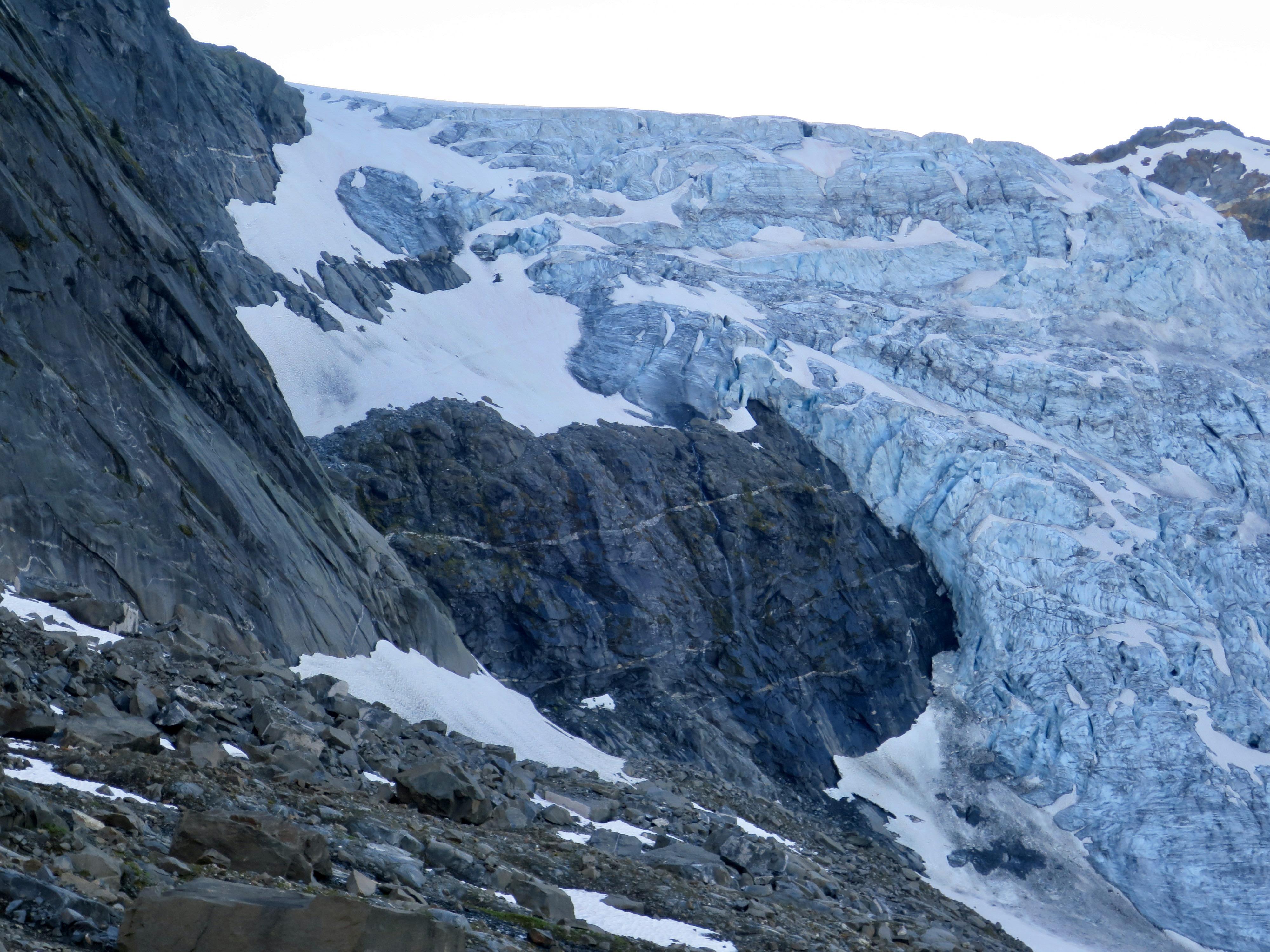
3. The toe of the Austerity Glacier (photo taken yesterday) flowing into Austerity Creek has become significantly more difficult and dangerous in the past week. Earlier in the summer it was a relatively safe and easy walk up and down, but no-one wanted to walk up there in the past week due to overhead rockfall hazard (from a gully hidden in the photo). The descent taken yesterday required 4-6 rappels/lowers to avoid most of the overhead rockfall hazard on the climbers left. The upper rappels were from ice anchors, but the lower rappels over the rock-slabs (4 x 30m) marked with cairns remain set up.
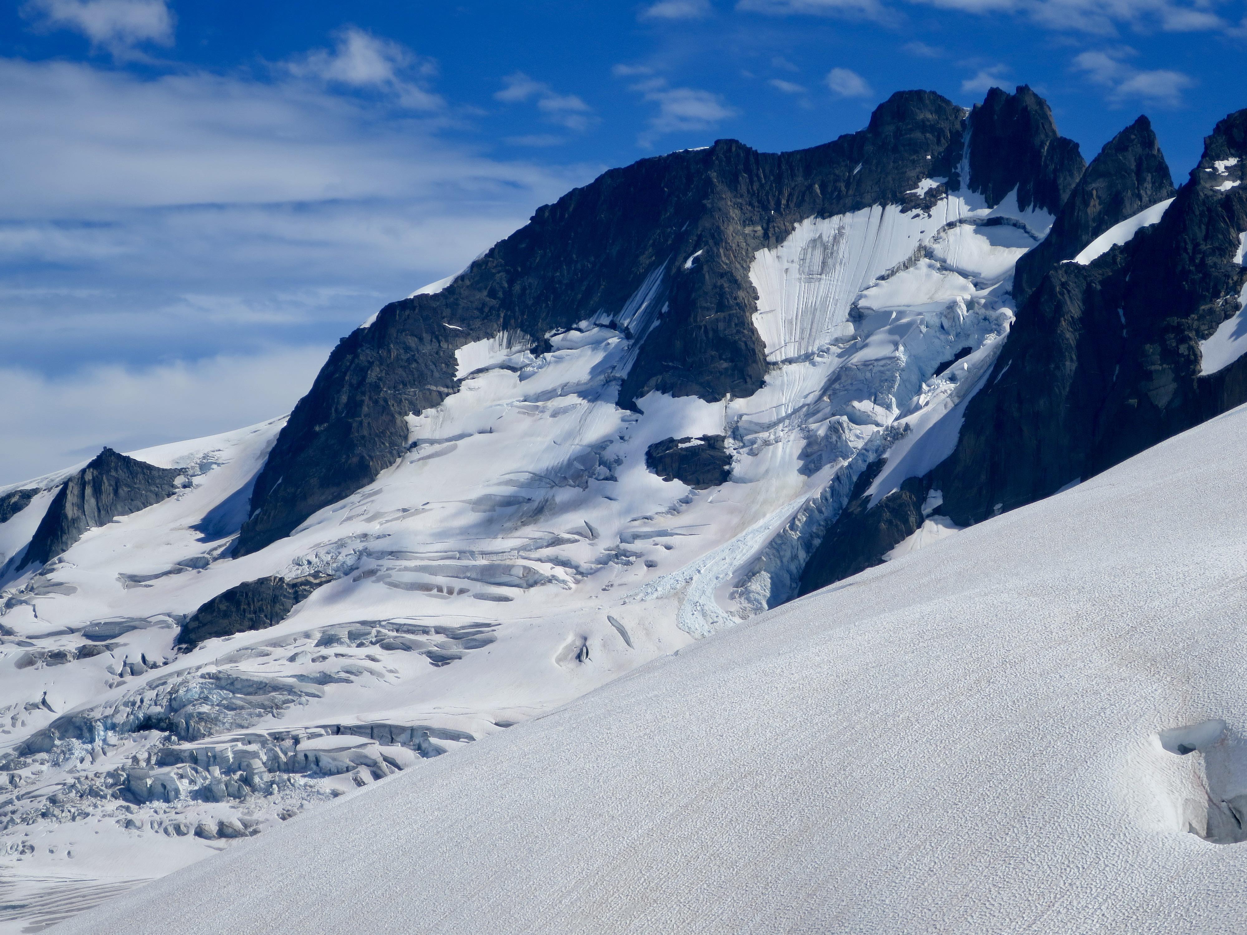
4. The North Faces of The Ironman and Austerity Mountain taken yesterday.
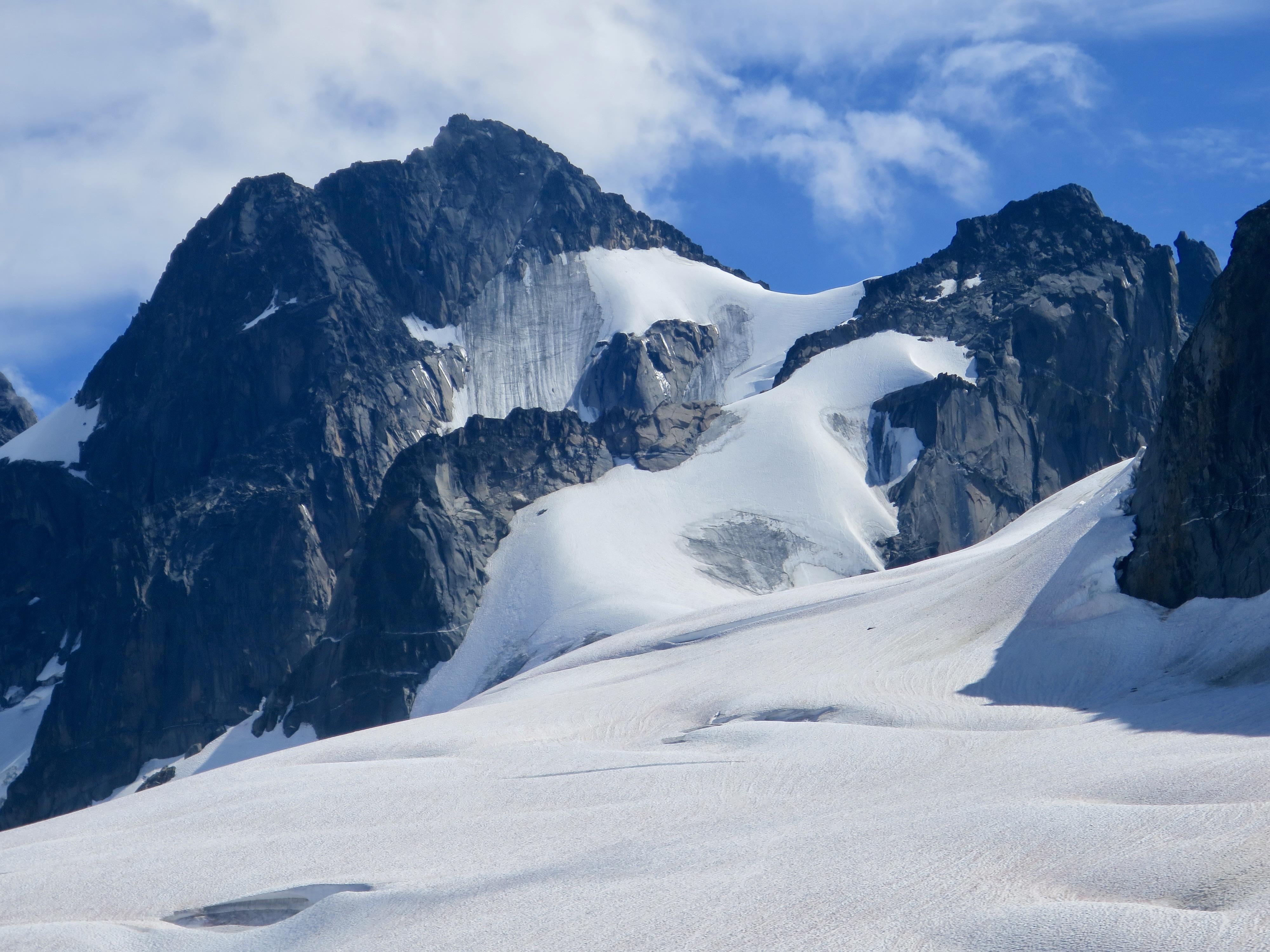
5. The North Face of Pioneer Peak taken yesterday.
There was a good freeze yesterday morning above 2300m. Even in the heat of the afternoon, snow travel has generally been excellent recently, sinking in just far enough to make good steps without crampons on anything less than 30 degrees incline.
Also of note, there is a steep rock slab of approximately 100m vertical on the way up to the Unicorn-Colossal Col (from Austerity Creek) starting at around 2500m elevation. It is mostly covered with grass, lichen or running with water. There are now 3 x 40-60m rappels set-up to get down, marked with cairns.
Great conditions out there at the moment, I hope you enjoy the remainder of your summer!
Alex Geary