Regional Summary for Rockies and Columbia Mountains September 2, 2021
The first signs of autumn arrived in Canmore this week, with some leaves already turning yellow. That said, it looks like we’ll be returning to more seasonal temperatures and conditions after a particularly wintery week in the mountains.
Weather
The forecast is generally good for the long weekend, except for some isolated rain expected in more northern regions. It should be relatively warm, with freezing levels climbing up to ~3000m during daytime highs.
Conditions
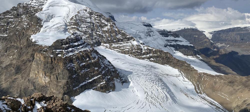
The remaining snow amounts are pretty variable. The front ranges are mainly dry, with a bit of snow lingering on higher, shady aspects, while up to 30cm can be found above 2800m in the Columbia Icefields (see attached recent photo from Jesse Milner). The Purcells and Selkriks seem to have received less snow with up to 10cm above 2500m on shady aspects and mostly snow-free conditions below 3000m on solar aspects. The good news is that we are likely getting pretty good overnight freezes in the alpine, and the bad news is we haven’t had enough snow to fix much of the mess this hot, dry summer created in areas of high melt.
Hazards
1- Rockfall is possible with all of the recent precipitation and lingering snow melting with the return of warmer temperatures.
2 - Crevasses may be hidden by thin, new bridges in areas where more snow has fallen. i.e. higher elevations in the Columbia Icefields.
3 - Avalanches, although not likely to be widespread, even small-ish slopes exposed to terrain traps should be treated with caution in areas of high snow accumulation.
What To Do?
I will still be treating mixed, glaciated alpine terrain with caution, given how bad conditions were just a short while ago. It could be a great weekend for hiking, scrambling, rock climbing and alpine climbing in areas where these hazards can be managed to meet your risk tolerance.
Marc Piché
ACMG Mountain Guide