ACMG Mountain Conditions Summary for the Rockies and Columbia Mountains. October 26th, 2018
Another beautiful autumn week in the Rockies and Interior BC, but looks like we're returning to a more typical colder weather pattern in the days to come. If snowfall amounts in the high Rockies and further west are substantial we will be back to early winter mode again with avalanche concerns rising back to the top of our list of hazards for mountain travel.
CLIMBING
The most interesting news of the week has been reports of extreme alpine ascents in the Rockies, especially around Hwy 93 South. High north sheltered ice climbing is definitely on, and conditions have been favourable with great overnight freezes (single digit below freezing), neve-like snow climbing, and minimal avalanche and rockfall concerns.
On the east slopes, around the Bow Valley for example, exposed south aspects are stripped of snow, and even today -- a cooler day than we've had recently -- if the sun comes out it will be enjoyable rock climbing on lower elevation south aspects.
SKIING
I haven't been able to dig up any reports of skiing this week. I'm sure it's happening though and I can't help but think that once you get up high you'll have great travel conditions on something like the Wapta. Sun exposed features have either be stripped of snow or have melt-freeze crusts, and the norths will be wind affected and facetted -- all in all generally poor skiing lately in return for a lot of effort. Keep in mind that the average snow depth at treeline ranges from zero to about 20 cm.
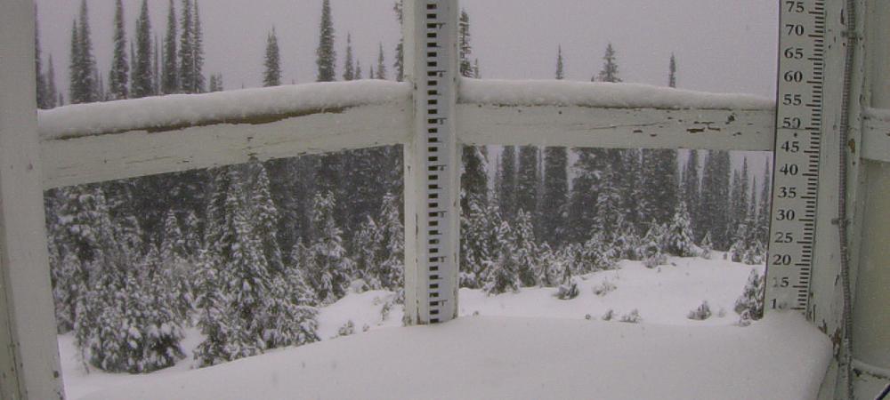
But that could be changing, and already in the Columbia mountains there's a refresh (10 cm at Fidelity and counting this morning, see photo) that will be sure to tempt many folks looking for freshies back into the alpine this weekend. Enough to make it worthwhile? Only one way to find out -- check social media Sunday night!
But seriously, if you choose to find out in person there will be the usual October caveats: long walks carrying skis to get to the alpine, hidden hazards like tree stumps and rocks to contend with, and tricky glacier travel. Now add flat light to the equation. If you end up on the ice, be sure to have your rope on and probe lots. Crevasses will be poorly bridged and hard to see. And of course be aware that any new snow falling, especially with wind, is overlying a mixed bag of facetted and crusted surfaces to bond to. As Mark Klassen mentioned last week, keep this in mind as you consider avalanche hazard in the coming weeks and months as it's not going to go away quickly.
In the Kootenays it's a similar story. David Lussier, who operates Summit Mountain Guides out of Nelson had this to report this morning: "Recent high pressure with temperature inversion moved out Tuesday night, looks like a wet pattern setting in. Temperatures in our area have been above seasonal values by a few degrees for a while now. It is not freezing in the valleys overnight (1000m to 700m) and when its not raining cragging is still a very good option. The local webcams suggest 5-10cm HN above 1800m last night. Most of the September snow has melted on solar aspects before the current system. There was still snow left on northerly aspects above treeline, guessing anywhere from 20 to 40cm. More in the Purcells than Selkirks."
HIKING
Despite a rough start, hiking over the past couple of weeks has been steadily improving below treeline levels although cleats are a definite must on icy, tree-shaded trails that see traffic. At treeline and in the alpine it's going to feel like winter -- snowshoes might help, and avalanche training and awareness is going to be a must from here on into the winter. Expect conditions to deteriorate over the next week as the snows set in.
Regards,
Tom Wolfe
Mountain Guide ACMG/IFMGA