ACMG Mountain Conditions Summary for the Rockies and Columbia Mountains - June 4th, 2020
As access slowly opens and we see more people getting back into the Rocky and Columbia Mountains, the biggest thing of note is the large amount of snow remaining compared to recent years.
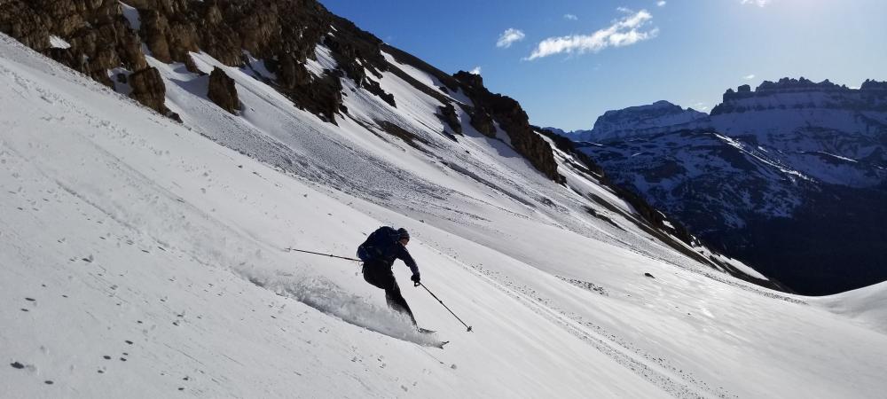
Recent snow survey flights in Kananaskis, and snow pillow data from the Banff and Yoho areas, show most places in the Rockies to be significantly above the historical norms for snowpack amounts at this time of year. This also holds true in the Columbias though some areas there are a little closer to normal. Still plenty of late season skiing opportunities for those willing to walk a little and trip reports of high objectives in Kananaskis, Rogers Pass, Banff and Jasper have been quite favorable!
In the Rockies the snowline is lingering around 2100-2300 m. You can expect snow on many shady aspects above this elevation, and on all aspects above this elevation in the deeper snowpack areas near the divide. Many trails above treeline remain largely snow covered and north facing alpine rock is generally not in shape yet.
South facing scrambles, rock climbs and alpine ridges in Eastern areas and lower elevations are generally snow free with the normal caveat to watch for loose rocks on all climbs after the winter season. Be prepared to encounter snow patches in gullies and higher elevation terrain and bring the appropriate gear to avoid slips on snow. A slide down into rocks or cliffs would not be fun.
Avalanche concerns are still present in many higher elevation areas with occasional large slides in the past two weeks. Daytime warming, rain, or warm overnight temperatures will each contribute to a rise in the avalanche hazard. If you are headed up high...bring avalanche gear, choose days with a good overnight freeze and travel very early on steep snow slopes to minimize the avalanche hazard. If hiking, climbing or scrambling, be aware that the slopes above you may still be holding snow and both rockfall and snow slides will increase with daytime heating/melting.
The glaciers are still generally well covered with good crevasse bridges and travel is easy on skis. Foot travel is entirely dependent on the overnight freeze as some recent postholing accounts can attest to.
Friday morning looks like a nice cold clear start to the day and a great morning to be enjoying some late season skiing or early alpine snow climbing up high. Precipitation starts to move in Friday night and at this point the weekend and early part of next week look fairly wet throughout the Rocky and Columbia mountains. The weather may be more suited to valley bottom activities like hikes, bikes and low elevation climbing. Ticks, bears, swollen creeks/rivers, icy trails and increased avalanche hazard will be worth keeping in mind depending on where you go, in addition to maintaining good Covid protocols.
Remember to check with the local land managers to see what areas are open and what limitations on access, activities or overnight stays may exist as our parks and provincial lands slowly open.
Have a great weekend!
Conrad Janzen
ACMG Mountain Guide