ACMG Mountain Conditions Summary for the Rockies and Columbia Mountains, July 26, 2019
The unsettled weather we have experienced this summer looks like it will continue through Saturday as a cold front produces some showers and thundershowers throughout the Rockies and Columbia's. A clearing trend Sunday as a high pressure system moves in looks like the start of a great time to be up high on some bigger objectives. The rest of the week currently looks quite nice with the possibility of afternoon thundershowers and some more unsettled weather later in the week.
Alpine climbing conditions are starting to come into shape. Below 3000 m most alpine rock ridge routes with good sun exposure are drying out and ready to go. Things like Castle Mountain, Mt Louis, the Gimli South Ridge, ridge routes in Rogers Pass and most sunny routes in the Bugaboos are generally dry and in good condition.
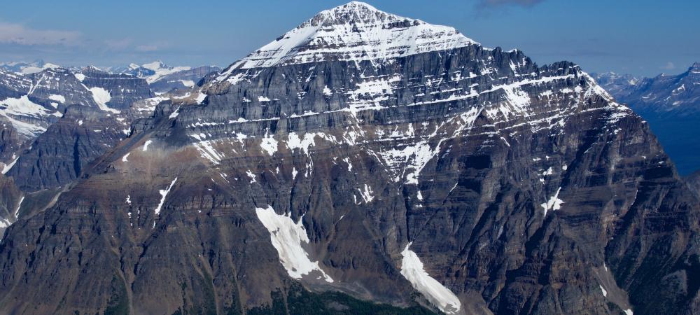
Routes that involve travel at higher elevations, especially on faces with large ledges, may still be holding snow patches that will start spitting rocks as a the temperatures warm up. For example things like the East Ridge of Mt Temple have been climbed but are still holding a lot of snow on the ledges and are not quite in optimal condition because of the potential rock fall (see photo). Assiniboine is still quite snowy but has been climbed. The NW Ridge of Sir Donald is in pretty good shape but the West Face bypass descent still has a fair bit of snow on it, and you may still find some wet rock or icy cracks in sheltered areas high up on routes like the Becky-Chouinard in the Bugaboos.
On higher more north facing routes and areas above 3000 m, there is still a fair bit of snow present and it could take a while for things to dry out this season. Even the scramble route up the SW Ridge of Mt Temple remains quite snowy in its upper third. Expect slower travel up high as a result.
Snow travel is of course dependent on the overnight temperatures but reports from the Rockies on Mt Joffre, Mt Fay, Resplendent and the Columbia Icefields, and in the Bugaboos and Rogers Pass areas have been of generally good travel in areas with more than a metre of snow over the ice, even with not much of a freeze. Watch for weakening crevasse bridges as the snowpack thins, and keep an eye on the few winter cornices still hanging around up high. Most recent avalanche concerns seem to have died down but wet sluffs with daytime warming will be likely at higher elevations. With a cool night and an early start and finish you could have some really good snow travel conditions this next week!
Have a good week!
Conrad Janzen
ACMG Mountain Guide