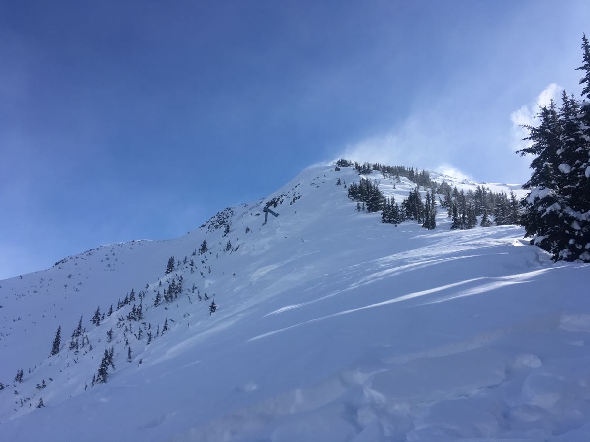
Went to make some observations in the Blowdown Peak area today. Gusty moderate to strong NE winds were redistributing surface snow and creating reverse loaded windslabs in the alpine and open areas at treeline. Surface hoar 5-10mm at treeline and in alpine getting blown away in exposed areas, and preserved below 5-10cm of snow in sheltered areas. On polar aspects, the crust under that snow breaks down and turns to facets above 1850m. Below treeline has a mostly solid crust that is slowly starting to facet buried by 5-10cm. Cornices are beginning to get stripped by the NE winds that are also contributing to reverse loading.
Ridgetop features wumphing and cracking easily within the wind transported snow.
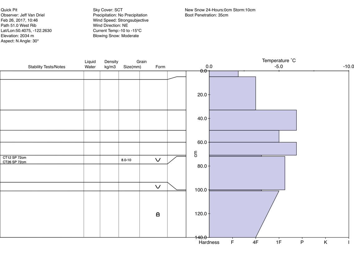
Test pit at 2030m on a ridgetop N aspect with a snowpack of 220cm produced moderate to hard compression test results down 72cm on early February surface hoar size 8-10mm.
There has been a number of sporadic reports of skier remote and skier/cornice triggering avalanches failing over 100cm down size 2-3(+) on polar aspects from neighboring terrain within past 96 hours. I suspect the early February surface hoar or December facets to be the culprit. Shallow snowpack areas on all aspects remain suspect.
Critical decision-making is becoming more complex out there.
Cheers
On The Map
These observations and opinions are those of the person who submitted them. The ACMG and its members take no responsibility for errors, omissions, or lapses in continuity. Conditions differ greatly over time and space due to the variable nature of mountain weather and terrain. Application of this information provides no guarantee of increased safety. Do not use the Mountain Conditions Report as the sole factor in planning trips or making decisions in the field.


