This info is a few days old but I have been meaning to bring people up to speed on the major changes in this area.
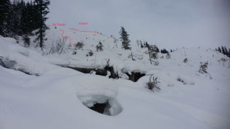
Last summer Corbin Pass received a major haircut in the form of several clearcuts. This includes 2 large blocks that exceed 40 degrees with a couple of hundred meters vertical relief - clearly avalanche terrain that could harm a skier. If you follow the usual route from the past (now labeled the 6100 road) you will have to walk on the road directly below these features - probably something you should do with respect for what is over your head ;-)
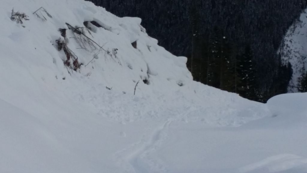
Since they are between 1100 and 1500m. it has taken a while for them to reach threshold snowdepths to be skiable as well as being capable of producing avalanches. This threshold was reached with the last snowfall just before New Years, and sure enough someone triggered (either directly or remotely?) a size 2 avalanche from the skiers right of the aforementioned blocks. The avalanche hit the road in 2 places with a deposit that was about 5 meters deep on the uphill side of the road - would have been nasty if someone had been walking up the road when that happened!
These cutblocks face SE and as a result there is a suncrust buried at the storm snow interface down 30-40cms in this location, something that becomes quite evident with even a few hand shears on the way up. It is also a prime location and elevation for surface hoar formation.
It is possible to avoid this hazard by continuing up what is now labeled the "Corbin" road past the "6100" road junction until you reach the "6200" road junction. This road can take you back to the West across the top of the cutblock and allow you to access the old skid road at the 1500m elevation which is above the steep cutblocks. Unfortunately it also adds some extra travel time, but is something to keep in mind on those stormy days.
All that is to say that this change affords both opportunity for some great skiing but it also presents some very real changes to the avalanche risk in the area.