Strathcona Provincial Park, Flower Ridge Trail - May 5, 2018
Vancouver Island, British Columbia, Canada

May 5, 2018
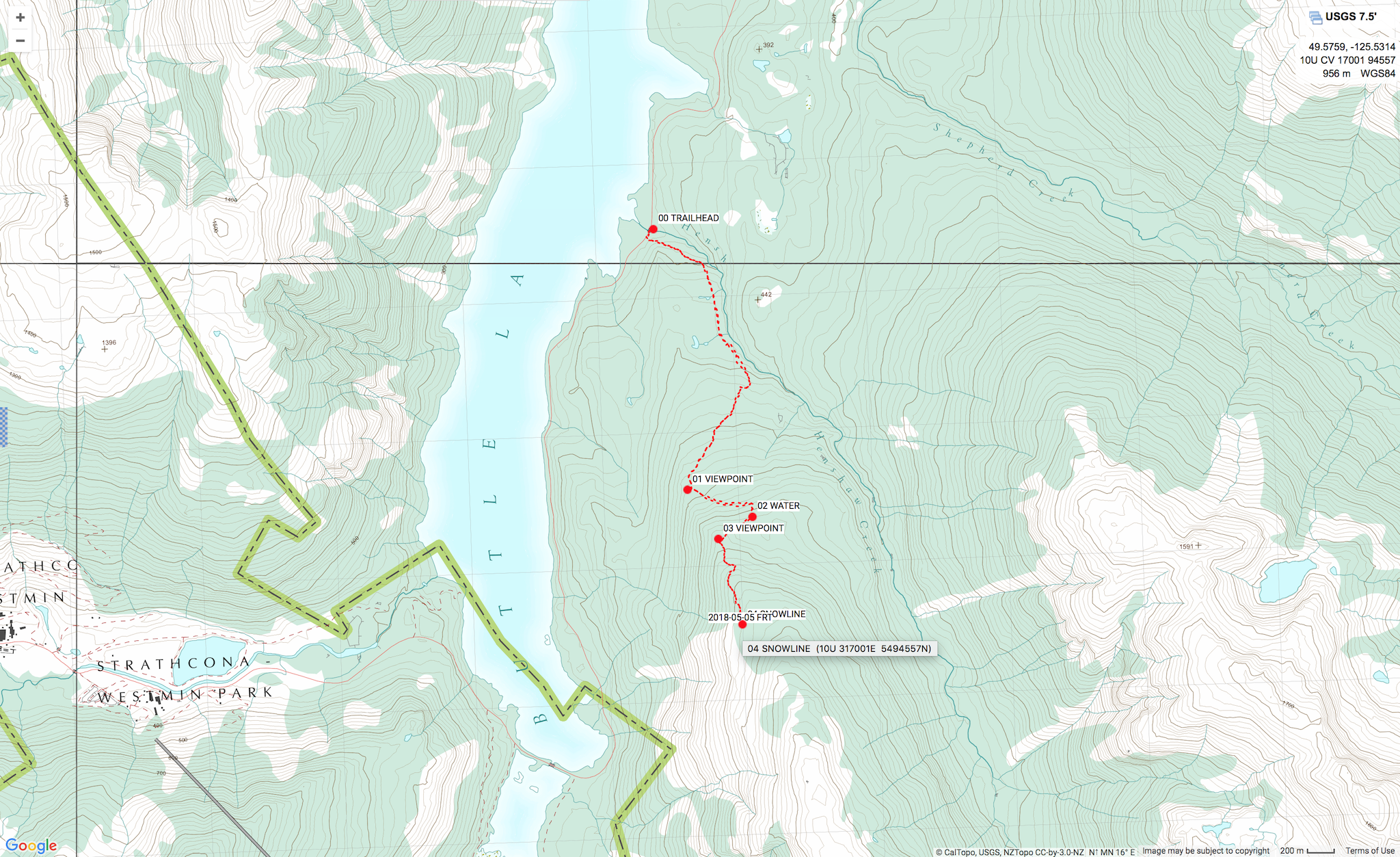
We day hiked 8.6 km on the Flower River Trail in Strathcona Provincial Park. Our main objectives were to check route conditions and snow line elevation.
Weather: Sunny, dry, warm day. High temperature 27ºC. Low temperature 10ºC. Winds Light NW. Pressure 1024 hPa.
Route: Started at Flower Ridge Trailhead, 230 m GR 164975. Hiked 4.3 km to snow line, 950 m GR 170945. Returned 4.3 km to finish at Flower Ridge Trailhead, 230 m GR 164975. (WGS84)
Notes: The balmy weather made for a superb early season reconnaissance hike. The route was dry to snow line, 950 m GR 170945. Snow pack above 950 m on NW aspect was 1-2 m deep, isothermal, and melting rapidly. We retreated after post holing to ground within 100 m on snow. We expect the snow line rising to ridge crest, 8 km 1400 m GR177922, by mid-June.
There are no BC Parks permits required for recreational hiking and/or camping on Flower Ridge. Access to the trailhead is via the Buttle Lake Parkway (Westmin Mine Road) 30 km south of Buttle Narrows and the Highway 28 junction. There is excellent vehicle accessible camping at Ralph River campground, 3.7 km north of the trailhead. The vehicle accessible camping fee is $20 per party / night. There are 75 sites, all FCFS with some reservable online through Discover Camping from May 11 to Sep 2. The campground is closed Nov 1 to Mar 31. The campground was recently updated with brand new amenities, including shiny new pit toilets.
The Flower Ridge Trail is one of Strathcona Park’s most efficient routes into the subalpine. The old trail has a gentle gradient rising 1100 m over 8 km. Once on top of the ridge, hikers are rewarded with sweeping views of the surrounding mountains and Buttle Lake below. The Flower Ridge Trail is an important access/egress of several multi-day expeditions in the East and South Strathcona zones. Check out Exploring Strathcona Park by Philip Stone for more detailed route information and a lifetime of ideas for backcountry treks in Strathcona Park.
Mike Blake
ACMG HG
mbguiding.ca